Villardondiego geodata
Villardondiego (Castille and León) is a seat of a third-order administrative division; located in Spain in Europe/Madrid (GMT+2) time zone. With population of 120 people, there are 5697 cities with bigger population in this country. Compared to other cities in Spain, 63.1% of cities are located further ↓South; 77.2% of cities are located further →East and 59% of cities have lower elevation than Villardondiego. Note1
Administrative division(s):
- Level 1: Castille and León
- Level 2: Provincia de Zamora
- Level 3: Villardondiego


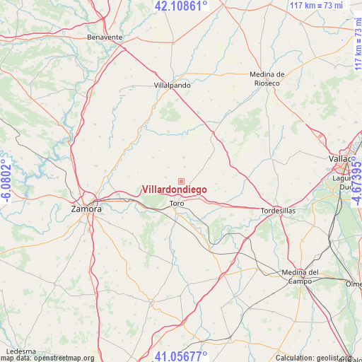
Villardondiego GPS coordinates[2]
41° 35' 5.388" North, 5° 22' 37.452" West
| Map corner | latitude | longitude |
|---|---|---|
| Upper-left | 42.10861°, | -6.0802° |
| Center: | 41.58483°, | -5.37707° |
| Lower-right: | 41.05677°, | -4.67395° |
| Map W x H: | 117×117 km | = 72.7×72.7mi |
| max Lat: | 43.74134° ⇑36.9% North |
| Villardondiego: | 41.58483° |
| min Lat: | ⇓63.1% South 27.64134° |
| min Long | Villardondiego | max Long |
| -18.00367° | -5.37707° | 4.2899° |
| W 22.8%⇐ | ⇒77.2% E |
Elevation
Elevation of Villardondiego is 737 m = 2418 ft, and this is 139 m = 456 ft above average elevation for this country.
| Max E: |
1682 m = 5518 ft | 41% |
| Villardondiego | 737 m 2418 ft | |
| Avg. | 598 m = 1962 ft | |
Min E: |
0 m = 0 ft | 59% |
See also: Spain elevation on elevation.city.
Geographical zone
Villardondiego is located in North temperate zone (between Tropic of Cancer and the Arctic Circle). Distance of this Northern Tropic circle is 2017.9 km =1253.9 mi to South.| Distance of | km | miles | from Villardondiego |
|---|---|---|---|
| North Pole | 5383.3 | 3345 | to North |
| Arctic Circle | 2777.4 | 1725.8 | to North |
| Tropic Cancer | 2017.9 | 1253.9 | to South |
| Equator | 4623.8 | 2873.1 | to South |


Nearby cities:
15 places around Villardondiego: (largest is in red/bold)
• Abezames
6.1 km =3.8 mi,  318°
318°
• Benafarces
8.1 km =5 mi,  59°
59°
• Casasola de Arión
11.4 km =7.1 mi,  93°
93°
• Castromembibre
11.4 km =7.1 mi,  31°
31°
• Fuentesecas
9.4 km =5.8 mi,  302°
302°
• Malva
12 km =7.5 mi,  310°
310°
• Matilla la Seca
10.3 km =6.4 mi,  266°
266°
• Morales de Toro
7.9 km =4.9 mi,  131°
131°
• Pinilla de Toro
4.9 km =3 mi,  12°
12°
• Pozoantiguo
5.1 km =3.2 mi,  285°
285°
• Tiedra
11.8 km =7.3 mi,  50°
50°
• Toro
6.9 km =4.3 mi,  192°
192°
• Vezdemarbán
7.8 km =4.8 mi, 6°
• Villalonso
6.8 km =4.2 mi,  77°
77°
• Villavendimio
2.9 km =1.8 mi,  104°
104°
Sources, notices
• [Note1] Compared only with cities in Spain existing in our database
• [Src1] Map data: © OpenStreetMap contributors (CC-BY-SA)
• [Src2] Other city data from geonames.org with taken over terms of usage.
• [Src3] Geographical zone / Annual Mean Temperature by Robert A. Rohde @ Wikipedia
