Villanueva de las Manzanas geodata
Villanueva de las Manzanas (Castille and León) is a seat of a third-order administrative division; located in Spain in Europe/Madrid (GMT+2) time zone. With population of 556 people, there are 3727 cities with bigger population in this country. Compared to other cities in Spain, 86.6% of cities are located further ↓South; 78.4% of cities are located further →East and 65.4% of cities have lower elevation than Villanueva de las Manzanas. Note1
Administrative division(s):
- Level 1: Castille and León
- Level 2: Provincia de León
- Level 3: Villanueva de las Manzanas
Current local time in Villanueva de las Manzanas:
11:07 PM, ThursdayDifference from your time zone: hours


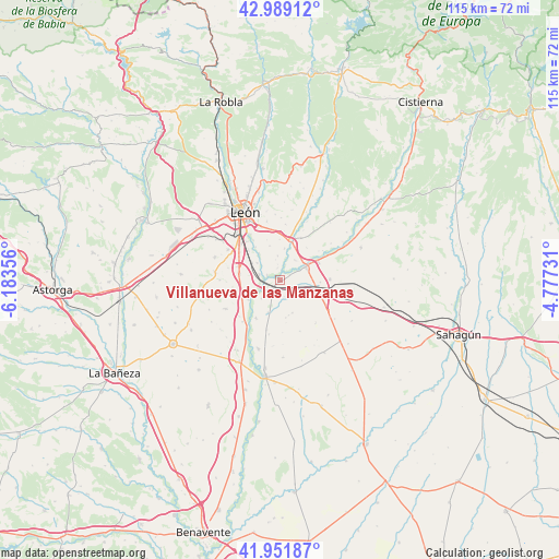
Villanueva de las Manzanas GPS coordinates[2]
42° 28' 21.504" North, 5° 28' 49.548" West
| Map corner | latitude | longitude |
|---|---|---|
| Upper-left | 42.98912°, | -6.18356° |
| Center: | 42.47264°, | -5.48043° |
| Lower-right: | 41.95187°, | -4.77731° |
| Map W x H: | 115.3×115.3 km | = 71.6×71.6mi |
| max Lat: | 43.74134° ⇑13.4% North |
| Villanueva de las Manzanas: | 42.47264° |
| min Lat: | ⇓86.6% South 27.64134° |
| min Long | Villanueva de l | max Long |
| -18.00367° | -5.48043° | 4.2899° |
| W 21.6%⇐ | ⇒78.4% E |
Elevation
Elevation of Villanueva de las Manzanas is 780 m = 2559 ft, and this is 182 m = 597 ft above average elevation for this country.
| Max E: |
1682 m = 5518 ft | 34.6% |
| Villanueva de las Manzanas | 780 m 2559 ft | |
| Avg. | 598 m = 1962 ft | |
Min E: |
0 m = 0 ft | 65.4% |
See also: Spain elevation on elevation.city.
Geographical zone
Villanueva de las Manzanas is located in North temperate zone (between Tropic of Cancer and the Arctic Circle). Distance of this Northern Tropic circle is 2116.6 km =1315.2 mi to South.| Distance of | km | miles | from Villanueva de las Manzanas |
|---|---|---|---|
| North Pole | 5284.5 | 3283.6 | to North |
| Arctic Circle | 2678.7 | 1664.5 | to North |
| Tropic Cancer | 2116.6 | 1315.2 | to South |
| Equator | 4722.5 | 2934.4 | to South |


Nearby cities:
15 places around Villanueva de las Manzanas: (largest is in red/bold)
• Ardón
7.7 km =4.8 mi,  238°
238°
• Cabreros del Río
9.3 km =5.8 mi,  212°
212°
• Campo de Villavidel
5.4 km =3.4 mi,  226°
226°
• Corbillos de los Oteros
7.4 km =4.6 mi,  166°
166°
• Cubillas de los Oteros
11.4 km =7.1 mi,  191°
191°
• Gusendos de los Oteros
11.3 km =7 mi,  158°
158°
• Mansilla Mayor
5.1 km =3.2 mi,  37°
37°
• Mansilla de las Mulas
5.9 km =3.7 mi,  60°
60°
• Onzonilla
10.1 km =6.3 mi,  304°
304°
• Santas Martas
10.1 km =6.3 mi,  116°
116°
• Valdefresno
13.6 km =8.5 mi,  355°
355°
• Valdevimbre
12.9 km =8 mi, 242°
• Vega de Infanzones
4.4 km =2.7 mi,  282°
282°
• Villasabariego
8.7 km =5.4 mi, 39°
• Villaturiel
5.1 km =3.2 mi,  354°
354°
Sources, notices
• [Note1] Compared only with cities in Spain existing in our database
• [Src1] Map data: © OpenStreetMap contributors (CC-BY-SA)
• [Src2] Other city data from geonames.org with taken over terms of usage.
• [Src3] Geographical zone / Annual Mean Temperature by Robert A. Rohde @ Wikipedia
