Villamuriel de Cerrato geodata
Villamuriel de Cerrato (Castille and León) is a seat of a third-order administrative division; located in Spain in Europe/Madrid (GMT+2) time zone. With population of 5,437 people, there are 1226 cities with bigger population in this country. Compared to other cities in Spain, 72.2% of cities are located further ↓South; 66.3% of cities are located further →East and 57.4% of cities have lower elevation than Villamuriel de Cerrato. Note1
Administrative division(s):
- Level 1: Castille and León
- Level 2: Provincia de Palencia
- Level 3: Villamuriel de Cerrato
Current local time in Villamuriel de Cerrato:
09:15 PM, ThursdayDifference from your time zone: hours


Villamuriel de Cerrato GPS coordinates[2]
41° 56' 57.66" North, 4° 30' 57.024" West
| Map corner | latitude | longitude |
|---|---|---|
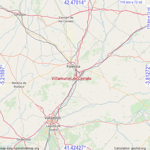
| Upper-left | 42.47014°, | -5.21897° |
| Center: | 41.94935°, | -4.51584° |
| Lower-right: | 41.42427°, | -3.81272° |
| Map W x H: | 116.3×116.3 km | = 72.3×72.3mi |
| max Lat: | 43.74134° ⇑27.8% North |
| Villamuriel de Cerrato: | 41.94935° |
| min Lat: | ⇓72.2% South 27.64134° |
| min Long | Villamuriel de | max Long |
| -18.00367° | -4.51584° | 4.2899° |
| W 33.7%⇐ | ⇒66.3% E |
Elevation
Elevation of Villamuriel de Cerrato is 726 m = 2382 ft, and this is 128 m = 420 ft above average elevation for this country.
| Max E: |
1682 m = 5518 ft | 42.6% |
| Villamuriel de Cerrato | 726 m 2382 ft | |
| Avg. | 598 m = 1962 ft | |
Min E: |
0 m = 0 ft | 57.4% |
See also: Spain elevation on elevation.city.
Geographical zone
Villamuriel de Cerrato is located in North temperate zone (between Tropic of Cancer and the Arctic Circle). Distance of this Northern Tropic circle is 2058.4 km =1279 mi to South.| Distance of | km | miles | from Villamuriel de Cerrato |
|---|---|---|---|
| North Pole | 5342.7 | 3319.8 | to North |
| Arctic Circle | 2736.8 | 1700.6 | to North |
| Tropic Cancer | 2058.4 | 1279 | to South |
| Equator | 4664.3 | 2898.3 | to South |


Nearby cities:
15 places around Villamuriel de Cerrato: (largest is in red/bold)
• Autilla del Pino
10.9 km =6.8 mi,  295°
295°
• Cevico de la Torre
14 km =8.7 mi,  141°
141°
• Dueñas
8.4 km =5.2 mi,  197°
197°
• Fuentes de Valdepero
14.1 km =8.8 mi,  5°
5°
• Grijota
12.8 km =8 mi,  334°
334°
• Hontoria de Cerrato
7.5 km =4.7 mi,  125°
125°
• Magaz
8.1 km =5 mi,  63°
63°
• Palencia
6.7 km =4.2 mi,  354°
354°
• Reinoso de Cerrato
11.4 km =7.1 mi,  74°
74°
• Santa Cecilia del Alcor
11.7 km =7.3 mi,  260°
260°
• Soto de Cerrato
7.1 km =4.4 mi,  86°
86°
• Tariego
5.8 km =3.6 mi,  149°
149°
• Valdeolmillos
14 km =8.7 mi,  43°
43°
• Venta de Baños
3.8 km =2.4 mi, 146°
• Villalobón
9.1 km =5.7 mi, 6°
Sources, notices
• [Note1] Compared only with cities in Spain existing in our database
• [Src1] Map data: © OpenStreetMap contributors (CC-BY-SA)
• [Src2] Other city data from geonames.org with taken over terms of usage.
• [Src3] Geographical zone / Annual Mean Temperature by Robert A. Rohde @ Wikipedia
