Villamartín de Don Sancho geodata
Villamartín de Don Sancho (Castille and León) is a seat of a third-order administrative division; located in Spain in Europe/Madrid (GMT+2) time zone. With population of 180 people, there are 5185 cities with bigger population in this country. Compared to other cities in Spain, 88.7% of cities are located further ↓South; 73.3% of cities are located further →East and 79.4% of cities have lower elevation than Villamartín de Don Sancho. Note1
Administrative division(s):
- Level 1: Castille and León
- Level 2: Provincia de León
- Level 3: Villamartín de Don Sancho
Current local time in Villamartín de Don Sancho:
11:59 PM, ThursdayDifference from your time zone: hours


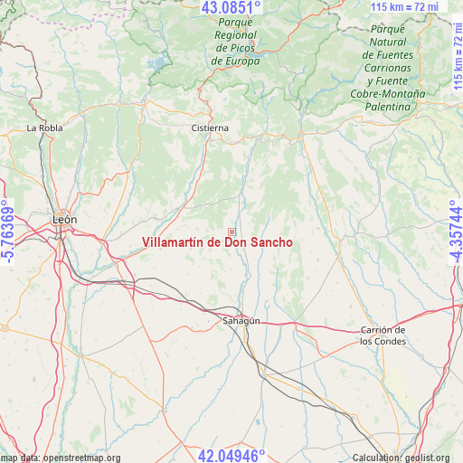
Villamartín de Don Sancho GPS coordinates[2]
42° 34' 9.948" North, 5° 3' 38.016" West
| Map corner | latitude | longitude |
|---|---|---|
| Upper-left | 43.0851°, | -5.76369° |
| Center: | 42.56943°, | -5.06056° |
| Lower-right: | 42.04946°, | -4.35744° |
| Map W x H: | 115.2×115.2 km | = 71.6×71.6mi |
| max Lat: | 43.74134° ⇑11.3% North |
| Villamartín de Don Sancho: | 42.56943° |
| min Lat: | ⇓88.7% South 27.64134° |
| min Long | Villamartín de | max Long |
| -18.00367° | -5.06056° | 4.2899° |
| W 26.7%⇐ | ⇒73.3% E |
Elevation
Elevation of Villamartín de Don Sancho is 892 m = 2927 ft, and this is 294 m = 965 ft above average elevation for this country.
| Max E: |
1682 m = 5518 ft | 20.6% |
| Villamartín de Don Sancho | 892 m 2927 ft | |
| Avg. | 598 m = 1962 ft | |
Min E: |
0 m = 0 ft | 79.4% |
See also: Spain elevation on elevation.city.
Geographical zone
Villamartín de Don Sancho is located in North temperate zone (between Tropic of Cancer and the Arctic Circle). Distance of this Northern Tropic circle is 2127.4 km =1321.9 mi to South.| Distance of | km | miles | from Villamartín de Don Sancho |
|---|---|---|---|
| North Pole | 5273.8 | 3277 | to North |
| Arctic Circle | 2667.9 | 1657.8 | to North |
| Tropic Cancer | 2127.4 | 1321.9 | to South |
| Equator | 4733.3 | 2941.1 | to South |


Nearby cities:
15 places around Villamartín de Don Sancho: (largest is in red/bold)
• Almanza
10.1 km =6.3 mi,  11°
11°
• Bercianos del Real Camino
21.4 km =13.3 mi,  198°
198°
• Calzada del Coto
20.4 km =12.7 mi,  184°
184°
• Cea
12.5 km =7.8 mi,  161°
161°
• Cebanico
17.6 km =10.9 mi, 9°
• Cubillas de Rueda
13.5 km =8.4 mi,  315°
315°
• El Burgo Ranero
20.9 km =13 mi,  218°
218°
• Gradefes
14.9 km =9.3 mi,  294°
294°
• Poza de la Vega
21.5 km =13.4 mi,  87°
87°
• Santa María del Monte de Cea
9.8 km =6.1 mi,  208°
208°
• Valdepolo
13.5 km =8.4 mi,  273°
273°
• Villamol
15.8 km =9.8 mi, 176°
• Villaselán
1.4 km =0.9 mi,  132°
132°
• Villazanzo de Valderaduey
8.7 km =5.4 mi,  115°
115°
• Villota del Páramo
17.4 km =10.8 mi,  96°
96°
Sources, notices
• [Note1] Compared only with cities in Spain existing in our database
• [Src1] Map data: © OpenStreetMap contributors (CC-BY-SA)
• [Src2] Other city data from geonames.org with taken over terms of usage.
• [Src3] Geographical zone / Annual Mean Temperature by Robert A. Rohde @ Wikipedia
