Cubillas de Rueda geodata
Cubillas de Rueda (Castille and León) is a seat of a third-order administrative division; located in Spain in Europe/Madrid (GMT+2) time zone. With population of 581 people, there are 3656 cities with bigger population in this country. Compared to other cities in Spain, 90.8% of cities are located further ↓South; 74.7% of cities are located further →East and 78.5% of cities have lower elevation than Cubillas de Rueda. Note1
Administrative division(s):
- Level 1: Castille and León
- Level 2: Provincia de León
- Level 3: Cubillas de Rueda


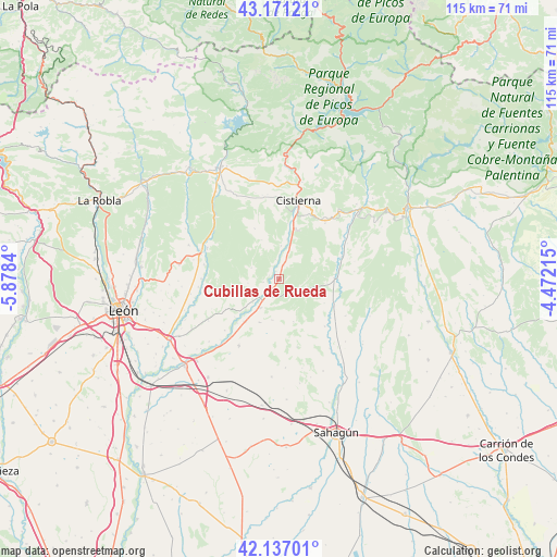
Cubillas de Rueda GPS coordinates[2]
42° 39' 22.536" North, 5° 10' 31.008" West
| Map corner | latitude | longitude |
|---|---|---|
| Upper-left | 43.17121°, | -5.8784° |
| Center: | 42.65626°, | -5.17528° |
| Lower-right: | 42.13701°, | -4.47215° |
| Map W x H: | 115×115 km | = 71.5×71.5mi |
| max Lat: | 43.74134° ⇑9.2% North |
| Cubillas de Rueda: | 42.65626° |
| min Lat: | ⇓90.8% South 27.64134° |
| min Long | Cubillas de Rue | max Long |
| -18.00367° | -5.17528° | 4.2899° |
| W 25.3%⇐ | ⇒74.7% E |
Elevation
Elevation of Cubillas de Rueda is 885 m = 2904 ft, and this is 287 m = 942 ft above average elevation for this country.
| Max E: |
1682 m = 5518 ft | 21.5% |
| Cubillas de Rueda | 885 m 2904 ft | |
| Avg. | 598 m = 1962 ft | |
Min E: |
0 m = 0 ft | 78.5% |
See also: Spain elevation on elevation.city.
Geographical zone
Cubillas de Rueda is located in North temperate zone (between Tropic of Cancer and the Arctic Circle). Distance of this Northern Tropic circle is 2137 km =1327.9 mi to South.| Distance of | km | miles | from Cubillas de Rueda |
|---|---|---|---|
| North Pole | 5264.1 | 3271 | to North |
| Arctic Circle | 2658.2 | 1651.7 | to North |
| Tropic Cancer | 2137 | 1327.9 | to South |
| Equator | 4742.9 | 2947.1 | to South |


Nearby cities:
15 places around Cubillas de Rueda: (largest is in red/bold)
• Almanza
11.4 km =7.1 mi,  88°
88°
• Cebanico
14.4 km =8.9 mi,  57°
57°
• Cistierna
16.8 km =10.4 mi,  13°
13°
• Gradefes
5.5 km =3.4 mi,  229°
229°
• La Ercina
17.8 km =11.1 mi,  348°
348°
• Prado de la Guzpeña
18.7 km =11.6 mi,  40°
40°
• Sabero
20.1 km =12.5 mi, 6°
• Santa Colomba de Curueño
22 km =13.7 mi,  298°
298°
• Santa María del Monte de Cea
18.9 km =11.7 mi,  165°
165°
• Valdepolo
9.7 km =6 mi,  204°
204°
• Vegaquemada
22.2 km =13.8 mi,  324°
324°
• Villamartín de Don Sancho
13.5 km =8.4 mi,  135°
135°
• Villasabariego
23.8 km =14.8 mi, 234°
• Villaselán
14.8 km =9.2 mi, 135°
• Villazanzo de Valderaduey
21.8 km =13.5 mi,  127°
127°
Sources, notices
• [Note1] Compared only with cities in Spain existing in our database
• [Src1] Map data: © OpenStreetMap contributors (CC-BY-SA)
• [Src2] Other city data from geonames.org with taken over terms of usage.
• [Src3] Geographical zone / Annual Mean Temperature by Robert A. Rohde @ Wikipedia
