Villalbilla de Gumiel geodata
Villalbilla de Gumiel (Castille and León) is a seat of a third-order administrative division; located in Spain in Europe/Madrid (GMT+2) time zone. With population of 120 people, there are 5697 cities with bigger population in this country. Compared to other cities in Spain, 68.6% of cities are located further ↓South; 54.2% of cities are located further →East and 81.8% of cities have lower elevation than Villalbilla de Gumiel. Note1
Administrative division(s):
- Level 1: Castille and León
- Level 2: Provincia de Burgos
- Level 3: Villalbilla de Gumiel
Current local time in Villalbilla de Gumiel:
11:59 PM, ThursdayDifference from your time zone: hours


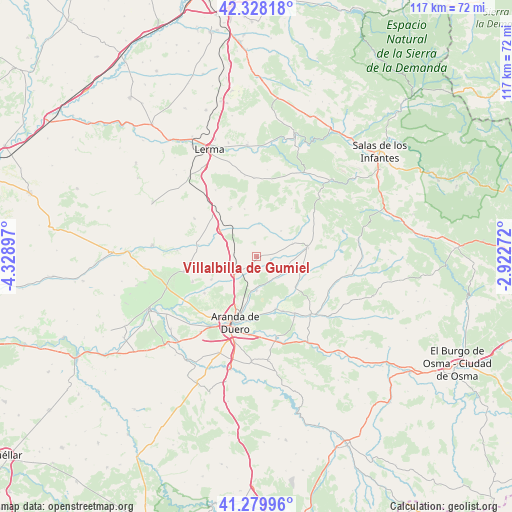
Villalbilla de Gumiel GPS coordinates[2]
41° 48' 22.356" North, 3° 37' 33.024" West
| Map corner | latitude | longitude |
|---|---|---|
| Upper-left | 42.32818°, | -4.32897° |
| Center: | 41.80621°, | -3.62584° |
| Lower-right: | 41.27996°, | -2.92272° |
| Map W x H: | 116.6×116.6 km | = 72.5×72.5mi |
| max Lat: | 43.74134° ⇑31.4% North |
| Villalbilla de Gumiel: | 41.80621° |
| min Lat: | ⇓68.6% South 27.64134° |
| min Long | Villalbilla de | max Long |
| -18.00367° | -3.62584° | 4.2899° |
| W 45.8%⇐ | ⇒54.2% E |
Elevation
Elevation of Villalbilla de Gumiel is 915 m = 3002 ft, and this is 317 m = 1040 ft above average elevation for this country.
| Max E: |
1682 m = 5518 ft | 18.2% |
| Villalbilla de Gumiel | 915 m 3002 ft | |
| Avg. | 598 m = 1962 ft | |
Min E: |
0 m = 0 ft | 81.8% |
See also: Spain elevation on elevation.city.
Geographical zone
Villalbilla de Gumiel is located in North temperate zone (between Tropic of Cancer and the Arctic Circle). Distance of this Northern Tropic circle is 2042.5 km =1269.2 mi to South.| Distance of | km | miles | from Villalbilla de Gumiel |
|---|---|---|---|
| North Pole | 5358.6 | 3329.7 | to North |
| Arctic Circle | 2752.8 | 1710.5 | to North |
| Tropic Cancer | 2042.5 | 1269.2 | to South |
| Equator | 4648.4 | 2888.4 | to South |


Nearby cities:
15 places around Villalbilla de Gumiel: (largest is in red/bold)
• Bahabón de Esgueva
10.6 km =6.6 mi,  305°
305°
• Baños de Valdearados
7.1 km =4.4 mi,  124°
124°
• Cabañes de Esgueva
13.7 km =8.5 mi,  281°
281°
• Caleruega
11.8 km =7.3 mi,  79°
79°
• Cilleruelo de Arriba
11.4 km =7.1 mi,  345°
345°
• Ciruelos de Cervera
13.6 km =8.5 mi,  35°
35°
• Gumiel de Izán
6.3 km =3.9 mi,  234°
234°
• Hontoria de Valdearados
11.1 km =6.9 mi,  127°
127°
• Oquillas
7.2 km =4.5 mi,  292°
292°
• Quemada
12.5 km =7.8 mi,  160°
160°
• Quintana del Pidio
11.7 km =7.3 mi,  243°
243°
• Tubilla del Lago
3.3 km =2.1 mi,  98°
98°
• Valdeande
8.6 km =5.3 mi,  69°
69°
• Villanueva de Gumiel
7.6 km =4.7 mi,  180°
180°
• Zazuar
13.7 km =8.5 mi,  154°
154°
Sources, notices
• [Note1] Compared only with cities in Spain existing in our database
• [Src1] Map data: © OpenStreetMap contributors (CC-BY-SA)
• [Src2] Other city data from geonames.org with taken over terms of usage.
• [Src3] Geographical zone / Annual Mean Temperature by Robert A. Rohde @ Wikipedia
