Valpalmas geodata
Valpalmas (Aragon) is a seat of a third-order administrative division; located in Spain in Europe/Madrid (GMT+2) time zone. With population of 166 people, there are 5297 cities with bigger population in this country. Compared to other cities in Spain, 78.1% of cities are located further ↓South; 78.3% of cities are located further ←West and 62.2% of cities have higher elevation than Valpalmas. Note1


Valpalmas GPS coordinates[2]
42° 9' 29.556" North, 0° 51' 17.316" West
| Map corner | latitude | longitude |
|---|---|---|
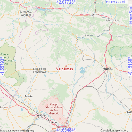
| Upper-left | 42.67728°, | -1.55793° |
| Center: | 42.15821°, | -0.85481° |
| Lower-right: | 41.63484°, | -0.15168° |
| Map W x H: | 115.9×115.9 km | = 72×72mi |
| max Lat: | 43.74134° ⇑21.9% North |
| Valpalmas: | 42.15821° |
| min Lat: | ⇓78.1% South 27.64134° |
| min Long | Valpalmas | max Long |
| -18.00367° | -0.85481° | 4.2899° |
| W 78.3%⇐ | ⇒21.7% E |
Elevation
Elevation of Valpalmas is 497 m = 1631 ft, and this is 101 m = 331 ft below average elevation for this country.
| Max E: |
1682 m = 5518 ft | 62.2% |
| Avg. | 598 m = 1962 ft | |
| Valpalmas | 497 m = 1631 ft | |
Min E: |
0 m = 0 ft | 37.8% |
See also: Spain elevation on elevation.city.
Geographical zone
Valpalmas is located in North temperate zone (between Tropic of Cancer and the Arctic Circle). Distance of this Northern Tropic circle is 2081.6 km =1293.4 mi to South.| Distance of | km | miles | from Valpalmas |
|---|---|---|---|
| North Pole | 5319.5 | 3305.4 | to North |
| Arctic Circle | 2713.6 | 1686.2 | to North |
| Tropic Cancer | 2081.6 | 1293.4 | to South |
| Equator | 4687.6 | 2912.7 | to South |


Nearby cities:
15 places around Valpalmas: (largest is in red/bold)
• Agüero
22.5 km =14 mi,  13°
13°
• Alcalá de Gurrea
17.3 km =10.7 mi,  126°
126°
• Asin
21 km =13 mi,  311°
311°
• Ayerbe
18.7 km =11.6 mi,  47°
47°
• Biscarrués
11.7 km =7.3 mi, 47°
• Castejón de Valdejasa
22.7 km =14.1 mi,  210°
210°
• Erla
9.1 km =5.7 mi,  239°
239°
• Gurrea de Gállego
17.6 km =10.9 mi,  154°
154°
• Loscorrales
20.5 km =12.7 mi,  58°
58°
• Luna
6.5 km =4 mi,  279°
279°
• Marracos
10.1 km =6.3 mi,  140°
140°
• Orés
18 km =11.2 mi,  317°
317°
• Piedratajada
5.9 km =3.7 mi, 134°
• Santa Eulalia de Gállego
16.3 km =10.1 mi,  28°
28°
• Sierra de Luna
13.1 km =8.1 mi,  200°
200°
Sources, notices
• [Note1] Compared only with cities in Spain existing in our database
• [Src1] Map data: © OpenStreetMap contributors (CC-BY-SA)
• [Src2] Other city data from geonames.org with taken over terms of usage.
• [Src3] Geographical zone / Annual Mean Temperature by Robert A. Rohde @ Wikipedia
