Valdunquillo geodata
Valdunquillo (Castille and León) is a seat of a third-order administrative division; located in Spain in Europe/Madrid (GMT+2) time zone. With population of 204 people, there are 5015 cities with bigger population in this country. Compared to other cities in Spain, 74.9% of cities are located further ↓South; 76.5% of cities are located further →East and 59.2% of cities have lower elevation than Valdunquillo. Note1
Administrative division(s):
- Level 1: Castille and León
- Level 2: Provincia de Valladolid
- Level 3: Valdunquillo


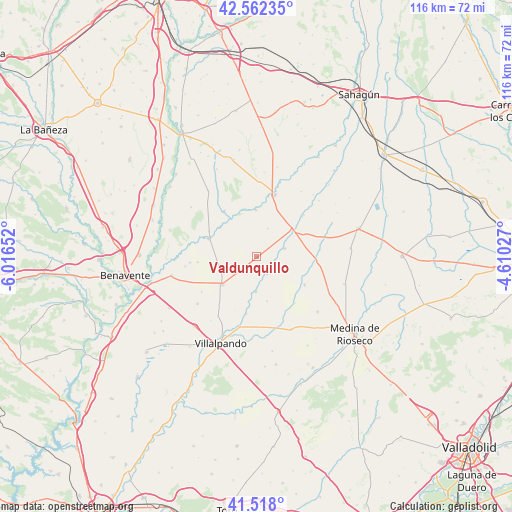
Valdunquillo GPS coordinates[2]
42° 2' 32.352" North, 5° 18' 48.204" West
| Map corner | latitude | longitude |
|---|---|---|
| Upper-left | 42.56235°, | -6.01652° |
| Center: | 42.04232°, | -5.31339° |
| Lower-right: | 41.518°, | -4.61027° |
| Map W x H: | 116.1×116.1 km | = 72.1×72.1mi |
| max Lat: | 43.74134° ⇑25.1% North |
| Valdunquillo: | 42.04232° |
| min Lat: | ⇓74.9% South 27.64134° |
| min Long | Valdunquillo | max Long |
| -18.00367° | -5.31339° | 4.2899° |
| W 23.5%⇐ | ⇒76.5% E |
Elevation
Elevation of Valdunquillo is 739 m = 2425 ft, and this is 141 m = 463 ft above average elevation for this country.
| Max E: |
1682 m = 5518 ft | 40.8% |
| Valdunquillo | 739 m 2425 ft | |
| Avg. | 598 m = 1962 ft | |
Min E: |
0 m = 0 ft | 59.2% |
See also: Spain elevation on elevation.city.
Geographical zone
Valdunquillo is located in North temperate zone (between Tropic of Cancer and the Arctic Circle). Distance of this Northern Tropic circle is 2068.7 km =1285.4 mi to South.| Distance of | km | miles | from Valdunquillo |
|---|---|---|---|
| North Pole | 5332.4 | 3313.4 | to North |
| Arctic Circle | 2726.5 | 1694.2 | to North |
| Tropic Cancer | 2068.7 | 1285.4 | to South |
| Equator | 4674.7 | 2904.7 | to South |


Nearby cities:
15 places around Valdunquillo: (largest is in red/bold)
• Aguilar de Campos
12.7 km =7.9 mi,  120°
120°
• Barcial de la Loma
10.4 km =6.5 mi,  166°
166°
• Becilla de Valderaduey
10.1 km =6.3 mi,  51°
51°
• Bolaños de Campos
4.6 km =2.9 mi,  148°
148°
• Castrobol
10.5 km =6.5 mi,  359°
359°
• Castroverde de Campos
8 km =5 mi,  180°
180°
• Ceinos de Campos
13.5 km =8.4 mi,  94°
94°
• Gordoncillo
12.7 km =7.9 mi,  324°
324°
• Quintanilla del Molar
12.7 km =7.9 mi,  242°
242°
• Urones de Castroponce
6.8 km =4.2 mi,  22°
22°
• Valderas
11.5 km =7.1 mi,  290°
290°
• Villalán de Campos
7.1 km =4.4 mi, 115°
• Villanueva del Campo
10 km =6.2 mi,  230°
230°
• Villar de Fallaves
13.2 km =8.2 mi,  189°
189°
• Villavicencio de los Caballeros
6.7 km =4.2 mi,  73°
73°
Sources, notices
• [Note1] Compared only with cities in Spain existing in our database
• [Src1] Map data: © OpenStreetMap contributors (CC-BY-SA)
• [Src2] Other city data from geonames.org with taken over terms of usage.
• [Src3] Geographical zone / Annual Mean Temperature by Robert A. Rohde @ Wikipedia
