Gordoncillo geodata
Gordoncillo (Castille and León) is a seat of a third-order administrative division; located in Spain in Europe/Madrid (GMT+2) time zone. With population of 637 people, there are 3529 cities with bigger population in this country. Compared to other cities in Spain, 77.5% of cities are located further ↓South; 77.4% of cities are located further →East and 61.4% of cities have lower elevation than Gordoncillo. Note1
Administrative division(s):
- Level 1: Castille and León
- Level 2: Provincia de León
- Level 3: Gordoncillo


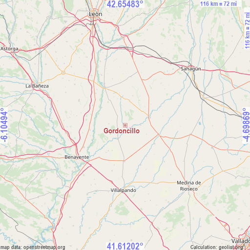
Gordoncillo GPS coordinates[2]
42° 8' 8.052" North, 5° 24' 6.516" West
| Map corner | latitude | longitude |
|---|---|---|
| Upper-left | 42.65483°, | -6.10494° |
| Center: | 42.13557°, | -5.40181° |
| Lower-right: | 41.61202°, | -4.69869° |
| Map W x H: | 115.9×115.9 km | = 72×72mi |
| max Lat: | 43.74134° ⇑22.5% North |
| Gordoncillo: | 42.13557° |
| min Lat: | ⇓77.5% South 27.64134° |
| min Long | Gordoncillo | max Long |
| -18.00367° | -5.40181° | 4.2899° |
| W 22.6%⇐ | ⇒77.4% E |
Elevation
Elevation of Gordoncillo is 753 m = 2470 ft, and this is 155 m = 509 ft above average elevation for this country.
| Max E: |
1682 m = 5518 ft | 38.6% |
| Gordoncillo | 753 m 2470 ft | |
| Avg. | 598 m = 1962 ft | |
Min E: |
0 m = 0 ft | 61.4% |
See also: Spain elevation on elevation.city.
Geographical zone
Gordoncillo is located in North temperate zone (between Tropic of Cancer and the Arctic Circle). Distance of this Northern Tropic circle is 2079.1 km =1291.9 mi to South.| Distance of | km | miles | from Gordoncillo |
|---|---|---|---|
| North Pole | 5322 | 3306.9 | to North |
| Arctic Circle | 2716.1 | 1687.7 | to North |
| Tropic Cancer | 2079.1 | 1291.9 | to South |
| Equator | 4685 | 2911.1 | to South |


Nearby cities:
15 places around Gordoncillo: (largest is in red/bold)
• Becilla de Valderaduey
15.7 km =9.8 mi,  104°
104°
• Campazas
7.6 km =4.7 mi,  275°
275°
• Castilfalé
9.5 km =5.9 mi,  350°
350°
• Castrobol
7.2 km =4.5 mi,  88°
88°
• Fuentes de Carbajal
5.9 km =3.7 mi,  322°
322°
• Izagre
15.5 km =9.6 mi,  50°
50°
• Mayorga
12 km =7.5 mi,  73°
73°
• Urones de Castroponce
10.7 km =6.6 mi,  112°
112°
• Valdemora
7 km =4.3 mi,  342°
342°
• Valderas
7.2 km =4.5 mi,  208°
208°
• Valdescorriel
15.4 km =9.6 mi,  215°
215°
• Valdunquillo
12.7 km =7.9 mi,  144°
144°
• Villabraz
12.9 km =8 mi, 343°
• Villaquejida
16.1 km =10 mi,  273°
273°
• Villavicencio de los Caballeros
16.1 km =10 mi,  121°
121°
Sources, notices
• [Note1] Compared only with cities in Spain existing in our database
• [Src1] Map data: © OpenStreetMap contributors (CC-BY-SA)
• [Src2] Other city data from geonames.org with taken over terms of usage.
• [Src3] Geographical zone / Annual Mean Temperature by Robert A. Rohde @ Wikipedia
