Valdezate geodata
Valdezate (Castille and León) is a seat of a third-order administrative division; located in Spain in Europe/Madrid (GMT+2) time zone. With population of 178 people, there are 5195 cities with bigger population in this country. Compared to other cities in Spain, 63.5% of cities are located further ↓South; 58.7% of cities are located further →East and 72.1% of cities have lower elevation than Valdezate. Note1
Administrative division(s):
- Level 1: Castille and León
- Level 2: Provincia de Burgos
- Level 3: Valdezate


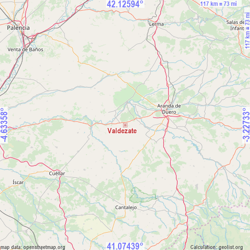
Valdezate GPS coordinates[2]
41° 36' 8.316" North, 3° 55' 49.62" West
| Map corner | latitude | longitude |
|---|---|---|
| Upper-left | 42.12594°, | -4.63358° |
| Center: | 41.60231°, | -3.93045° |
| Lower-right: | 41.07439°, | -3.22733° |
| Map W x H: | 116.9×116.9 km | = 72.6×72.6mi |
| max Lat: | 43.74134° ⇑36.5% North |
| Valdezate: | 41.60231° |
| min Lat: | ⇓63.5% South 27.64134° |
| min Long | Valdezate | max Long |
| -18.00367° | -3.93045° | 4.2899° |
| W 41.3%⇐ | ⇒58.7% E |
Elevation
Elevation of Valdezate is 828 m = 2717 ft, and this is 230 m = 755 ft above average elevation for this country.
| Max E: |
1682 m = 5518 ft | 27.9% |
| Valdezate | 828 m 2717 ft | |
| Avg. | 598 m = 1962 ft | |
Min E: |
0 m = 0 ft | 72.1% |
See also: Spain elevation on elevation.city.
Geographical zone
Valdezate is located in North temperate zone (between Tropic of Cancer and the Arctic Circle). Distance of this Northern Tropic circle is 2019.8 km =1255 mi to South.| Distance of | km | miles | from Valdezate |
|---|---|---|---|
| North Pole | 5381.3 | 3343.8 | to North |
| Arctic Circle | 2775.4 | 1724.6 | to North |
| Tropic Cancer | 2019.8 | 1255 | to South |
| Equator | 4625.7 | 2874.3 | to South |


Nearby cities:
15 places around Valdezate: (largest is in red/bold)
• Adrada de Haza
9 km =5.6 mi,  95°
95°
• Berlangas de Roa
10.8 km =6.7 mi,  26°
26°
• Castrillo de Duero
7.7 km =4.8 mi,  246°
246°
• Cuevas de Provanco
7.2 km =4.5 mi,  201°
201°
• Fuentecén
5.9 km =3.7 mi,  60°
60°
• Fuentelisendo
3.3 km =2.1 mi,  46°
46°
• Fuentemolinos
6.7 km =4.2 mi,  87°
87°
• Haza
9.6 km =6 mi,  80°
80°
• Hoyales de Roa
8.5 km =5.3 mi,  42°
42°
• Mambrilla de Castrejón
8.4 km =5.2 mi,  327°
327°
• Nava de Roa
3.1 km =1.9 mi,  293°
293°
• Olmos de Peñafiel
10 km =6.2 mi, 249°
• Roa
10.5 km =6.5 mi,  1°
1°
• San Martín de Rubiales
6.7 km =4.2 mi,  311°
311°
• Valdearcos de la Vega
10.8 km =6.7 mi, 294°
Sources, notices
• [Note1] Compared only with cities in Spain existing in our database
• [Src1] Map data: © OpenStreetMap contributors (CC-BY-SA)
• [Src2] Other city data from geonames.org with taken over terms of usage.
• [Src3] Geographical zone / Annual Mean Temperature by Robert A. Rohde @ Wikipedia
