Berlangas de Roa geodata
Berlangas de Roa (Castille and León) is a seat of a third-order administrative division; located in Spain in Europe/Madrid (GMT+2) time zone. With population of 219 people, there are 4924 cities with bigger population in this country. Compared to other cities in Spain, 65.9% of cities are located further ↓South; 57.9% of cities are located further →East and 65.8% of cities have lower elevation than Berlangas de Roa. Note1
Administrative division(s):
- Level 1: Castille and León
- Level 2: Provincia de Burgos
- Level 3: Berlangas de Roa


Berlangas de Roa GPS coordinates[2]
41° 41' 20.868" North, 3° 52' 22.224" West
| Map corner | latitude | longitude |
|---|---|---|
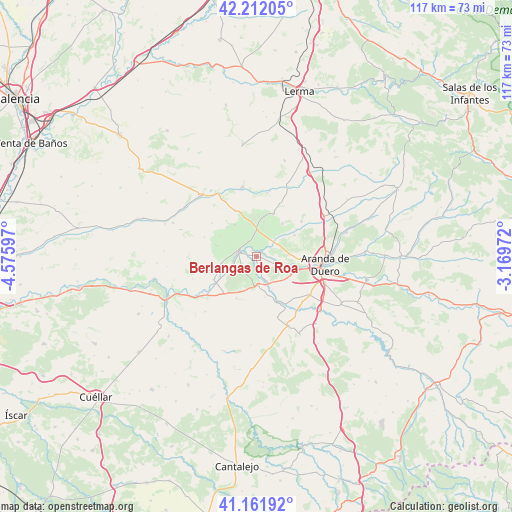
| Upper-left | 42.21205°, | -4.57597° |
| Center: | 41.68913°, | -3.87284° |
| Lower-right: | 41.16192°, | -3.16972° |
| Map W x H: | 116.8×116.8 km | = 72.6×72.6mi |
| max Lat: | 43.74134° ⇑34.1% North |
| Berlangas de Roa: | 41.68913° |
| min Lat: | ⇓65.9% South 27.64134° |
| min Long | Berlangas de Ro | max Long |
| -18.00367° | -3.87284° | 4.2899° |
| W 42.1%⇐ | ⇒57.9% E |
Elevation
Elevation of Berlangas de Roa is 783 m = 2569 ft, and this is 185 m = 607 ft above average elevation for this country.
| Max E: |
1682 m = 5518 ft | 34.2% |
| Berlangas de Roa | 783 m 2569 ft | |
| Avg. | 598 m = 1962 ft | |
Min E: |
0 m = 0 ft | 65.8% |
See also: Spain elevation on elevation.city.
Geographical zone
Berlangas de Roa is located in North temperate zone (between Tropic of Cancer and the Arctic Circle). Distance of this Northern Tropic circle is 2029.5 km =1261.1 mi to South.| Distance of | km | miles | from Berlangas de Roa |
|---|---|---|---|
| North Pole | 5371.7 | 3337.8 | to North |
| Arctic Circle | 2765.8 | 1718.6 | to North |
| Tropic Cancer | 2029.5 | 1261.1 | to South |
| Equator | 4635.4 | 2880.3 | to South |


Nearby cities:
15 places around Berlangas de Roa: (largest is in red/bold)
• Adrada de Haza
11.3 km =7 mi,  158°
158°
• Anguix
8.6 km =5.3 mi,  325°
325°
• Castrillo de la Vega
8.7 km =5.4 mi,  118°
118°
• Fuentecén
6.7 km =4.2 mi,  177°
177°
• Fuentelisendo
7.8 km =4.8 mi,  197°
197°
• Fuentemolinos
9.6 km =6 mi,  168°
168°
• Haza
9.3 km =5.8 mi,  149°
149°
• Hoyales de Roa
3.5 km =2.2 mi, 165°
• Mambrilla de Castrejón
9.6 km =6 mi,  254°
254°
• Pedrosa de Duero
9.9 km =6.2 mi,  285°
285°
• Roa
4.6 km =2.9 mi,  280°
280°
• San Martín de Rubiales
11.2 km =7 mi,  241°
241°
• Sotillo de la Ribera
10.6 km =6.6 mi,  21°
21°
• Valdezate
10.8 km =6.7 mi,  206°
206°
• Villalba de Duero
10.7 km =6.6 mi,  93°
93°
Sources, notices
• [Note1] Compared only with cities in Spain existing in our database
• [Src1] Map data: © OpenStreetMap contributors (CC-BY-SA)
• [Src2] Other city data from geonames.org with taken over terms of usage.
• [Src3] Geographical zone / Annual Mean Temperature by Robert A. Rohde @ Wikipedia
