Valdescorriel geodata
Valdescorriel (Castille and León) is a seat of a third-order administrative division; located in Spain in Europe/Madrid (GMT+2) time zone. With population of 191 people, there are 5099 cities with bigger population in this country. Compared to other cities in Spain, 74.3% of cities are located further ↓South; 78.8% of cities are located further →East and 58.9% of cities have lower elevation than Valdescorriel. Note1
Administrative division(s):
- Level 1: Castille and León
- Level 2: Provincia de Zamora
- Level 3: Valdescorriel


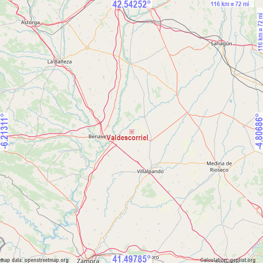
Valdescorriel GPS coordinates[2]
42° 1' 20.388" North, 5° 30' 35.928" West
| Map corner | latitude | longitude |
|---|---|---|
| Upper-left | 42.54252°, | -6.21311° |
| Center: | 42.02233°, | -5.50998° |
| Lower-right: | 41.49785°, | -4.80686° |
| Map W x H: | 116.2×116.2 km | = 72.2×72.2mi |
| max Lat: | 43.74134° ⇑25.7% North |
| Valdescorriel: | 42.02233° |
| min Lat: | ⇓74.3% South 27.64134° |
| min Long | Valdescorriel | max Long |
| -18.00367° | -5.50998° | 4.2899° |
| W 21.2%⇐ | ⇒78.8% E |
Elevation
Elevation of Valdescorriel is 736 m = 2415 ft, and this is 138 m = 453 ft above average elevation for this country.
| Max E: |
1682 m = 5518 ft | 41.1% |
| Valdescorriel | 736 m 2415 ft | |
| Avg. | 598 m = 1962 ft | |
Min E: |
0 m = 0 ft | 58.9% |
See also: Spain elevation on elevation.city.
Geographical zone
Valdescorriel is located in North temperate zone (between Tropic of Cancer and the Arctic Circle). Distance of this Northern Tropic circle is 2066.5 km =1284.1 mi to South.| Distance of | km | miles | from Valdescorriel |
|---|---|---|---|
| North Pole | 5334.6 | 3314.8 | to North |
| Arctic Circle | 2728.7 | 1695.5 | to North |
| Tropic Cancer | 2066.5 | 1284.1 | to South |
| Equator | 4672.4 | 2903.3 | to South |


Nearby cities:
15 places around Valdescorriel: (largest is in red/bold)
• Campazas
13.4 km =8.3 mi,  5°
5°
• Castrogonzalo
8.4 km =5.2 mi,  245°
245°
• Cerecinos de Campos
13.7 km =8.5 mi,  171°
171°
• Cimanes de la Vega
12.8 km =8 mi,  325°
325°
• Fuentes de Ropel
3.6 km =2.2 mi,  234°
234°
• Prado
13.5 km =8.4 mi,  146°
146°
• Quintanilla del Molar
6.2 km =3.9 mi,  126°
126°
• San Cristóbal de Entreviñas
10.6 km =6.6 mi,  284°
284°
• San Esteban del Molar
10.1 km =6.3 mi,  199°
199°
• Valderas
8.3 km =5.2 mi,  41°
41°
• Vega de Villalobos
6.9 km =4.3 mi, 146°
• Vidayanes
13.6 km =8.5 mi, 203°
• Villalobos
9 km =5.6 mi,  161°
161°
• Villanueva de Azoague
13.7 km =8.5 mi, 247°
• Villanueva del Campo
9.5 km =5.9 mi,  115°
115°
Sources, notices
• [Note1] Compared only with cities in Spain existing in our database
• [Src1] Map data: © OpenStreetMap contributors (CC-BY-SA)
• [Src2] Other city data from geonames.org with taken over terms of usage.
• [Src3] Geographical zone / Annual Mean Temperature by Robert A. Rohde @ Wikipedia
