Valdemaluque geodata
Valdemaluque (Castille and León) is a seat of a third-order administrative division; located in Spain in Europe/Madrid (GMT+2) time zone. With population of 244 people, there are 4780 cities with bigger population in this country. Compared to other cities in Spain, 65.3% of cities are located further ↓South; 53.7% of cities are located further ←West and 84.4% of cities have lower elevation than Valdemaluque. Note1
Administrative division(s):
- Level 1: Castille and León
- Level 2: Provincia de Soria
- Level 3: Valdemaluque


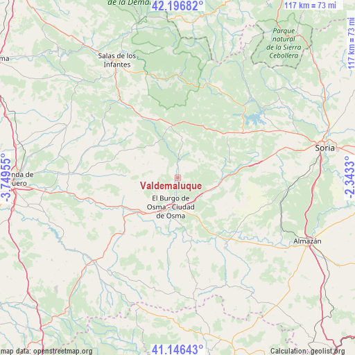
Valdemaluque GPS coordinates[2]
41° 40' 25.572" North, 3° 2' 47.148" West
| Map corner | latitude | longitude |
|---|---|---|
| Upper-left | 42.19682°, | -3.74955° |
| Center: | 41.67377°, | -3.04643° |
| Lower-right: | 41.14643°, | -2.3433° |
| Map W x H: | 116.8×116.8 km | = 72.6×72.6mi |
| max Lat: | 43.74134° ⇑34.7% North |
| Valdemaluque: | 41.67377° |
| min Lat: | ⇓65.3% South 27.64134° |
| min Long | Valdemaluque | max Long |
| -18.00367° | -3.04643° | 4.2899° |
| W 53.7%⇐ | ⇒46.3% E |
Elevation
Elevation of Valdemaluque is 944 m = 3097 ft, and this is 346 m = 1135 ft above average elevation for this country.
| Max E: |
1682 m = 5518 ft | 15.6% |
| Valdemaluque | 944 m 3097 ft | |
| Avg. | 598 m = 1962 ft | |
Min E: |
0 m = 0 ft | 84.4% |
See also: Spain elevation on elevation.city.
Geographical zone
Valdemaluque is located in North temperate zone (between Tropic of Cancer and the Arctic Circle). Distance of this Northern Tropic circle is 2027.8 km =1260 mi to South.| Distance of | km | miles | from Valdemaluque |
|---|---|---|---|
| North Pole | 5373.4 | 3338.9 | to North |
| Arctic Circle | 2767.5 | 1719.6 | to North |
| Tropic Cancer | 2027.8 | 1260 | to South |
| Equator | 4633.7 | 2879.2 | to South |


Nearby cities:
15 places around Valdemaluque: (largest is in red/bold)
• Blacos
15.6 km =9.7 mi,  87°
87°
• Casarejos
13.7 km =8.5 mi,  4°
4°
• Cubilla
12.3 km =7.6 mi,  47°
47°
• El Burgo de Osma
9.9 km =6.2 mi,  189°
189°
• Fuentearmegil
12.3 km =7.6 mi,  291°
291°
• Herrera de Soria
10.3 km =6.4 mi,  15°
15°
• Muriel Viejo
16.3 km =10.1 mi,  41°
41°
• Muriel de la Fuente
16.4 km =10.2 mi,  70°
70°
• Nafría de Ucero
6.8 km =4.2 mi,  323°
323°
• San Esteban de Gormaz
17.1 km =10.6 mi,  229°
229°
• Santa María de las Hoyas
13.4 km =8.3 mi, 323°
• Torreblacos
13.9 km =8.6 mi, 92°
• Ucero
4.8 km =3 mi,  354°
354°
• Vadillo
13.4 km =8.3 mi,  13°
13°
• Valdenebro
13.2 km =8.2 mi,  148°
148°
Sources, notices
• [Note1] Compared only with cities in Spain existing in our database
• [Src1] Map data: © OpenStreetMap contributors (CC-BY-SA)
• [Src2] Other city data from geonames.org with taken over terms of usage.
• [Src3] Geographical zone / Annual Mean Temperature by Robert A. Rohde @ Wikipedia
