Fuentearmegil geodata
Fuentearmegil (Castille and León) is a seat of a third-order administrative division; located in Spain in Europe/Madrid (GMT+2) time zone. With population of 282 people, there are 4578 cities with bigger population in this country. Compared to other cities in Spain, 66.4% of cities are located further ↓South; 51.8% of cities are located further ←West and 87.2% of cities have lower elevation than Fuentearmegil. Note1
Administrative division(s):
- Level 1: Castille and León
- Level 2: Provincia de Soria
- Level 3: Fuentearmegil


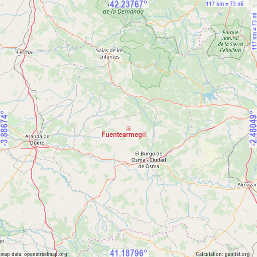
Fuentearmegil GPS coordinates[2]
41° 42' 53.856" North, 3° 11' 1.032" West
| Map corner | latitude | longitude |
|---|---|---|
| Upper-left | 42.23767°, | -3.88674° |
| Center: | 41.71496°, | -3.18362° |
| Lower-right: | 41.18796°, | -2.48049° |
| Map W x H: | 116.7×116.7 km | = 72.5×72.5mi |
| max Lat: | 43.74134° ⇑33.6% North |
| Fuentearmegil: | 41.71496° |
| min Lat: | ⇓66.4% South 27.64134° |
| min Long | Fuentearmegil | max Long |
| -18.00367° | -3.18362° | 4.2899° |
| W 51.8%⇐ | ⇒48.2% E |
Elevation
Elevation of Fuentearmegil is 985 m = 3232 ft, and this is 387 m = 1270 ft above average elevation for this country.
| Max E: |
1682 m = 5518 ft | 12.8% |
| Fuentearmegil | 985 m 3232 ft | |
| Avg. | 598 m = 1962 ft | |
Min E: |
0 m = 0 ft | 87.2% |
See also: Spain elevation on elevation.city.
Geographical zone
Fuentearmegil is located in North temperate zone (between Tropic of Cancer and the Arctic Circle). Distance of this Northern Tropic circle is 2032.3 km =1262.8 mi to South.| Distance of | km | miles | from Fuentearmegil |
|---|---|---|---|
| North Pole | 5368.8 | 3336 | to North |
| Arctic Circle | 2762.9 | 1716.8 | to North |
| Tropic Cancer | 2032.3 | 1262.8 | to South |
| Equator | 4638.3 | 2882.1 | to South |


Nearby cities:
15 places around Fuentearmegil: (largest is in red/bold)
• Alcubilla de Avellaneda
10.1 km =6.3 mi,  276°
276°
• Brazacorta
15.2 km =9.4 mi,  271°
271°
• Casarejos
15.5 km =9.6 mi,  54°
54°
• El Burgo de Osma
17.4 km =10.8 mi,  145°
145°
• Espeja de San Marcelino
10.2 km =6.3 mi,  341°
341°
• Espejón
14.3 km =8.9 mi,  333°
333°
• Herrera de Soria
15.2 km =9.4 mi,  69°
69°
• Hontoria del Pinar
14.9 km =9.3 mi,  6°
6°
• Nafría de Ucero
7.4 km =4.6 mi,  83°
83°
• San Esteban de Gormaz
15.7 km =9.8 mi,  186°
186°
• San Leonardo de Yagüe
16 km =9.9 mi,  36°
36°
• Santa María de las Hoyas
7.2 km =4.5 mi,  28°
28°
• Ucero
11 km =6.8 mi,  88°
88°
• Vadillo
16.8 km =10.4 mi,  59°
59°
• Valdemaluque
12.3 km =7.6 mi,  111°
111°
Sources, notices
• [Note1] Compared only with cities in Spain existing in our database
• [Src1] Map data: © OpenStreetMap contributors (CC-BY-SA)
• [Src2] Other city data from geonames.org with taken over terms of usage.
• [Src3] Geographical zone / Annual Mean Temperature by Robert A. Rohde @ Wikipedia
