Santoyo geodata
Santoyo (Castille and León) is a seat of a third-order administrative division; located in Spain in Europe/Madrid (GMT+2) time zone. With population of 260 people, there are 4682 cities with bigger population in this country. Compared to other cities in Spain, 79.6% of cities are located further ↓South; 64.3% of cities are located further →East and 67.8% of cities have lower elevation than Santoyo. Note1
Administrative division(s):
- Level 1: Castille and León
- Level 2: Provincia de Palencia
- Level 3: Santoyo


Santoyo GPS coordinates[2]
42° 12' 53.028" North, 4° 20' 34.656" West
| Map corner | latitude | longitude |
|---|---|---|
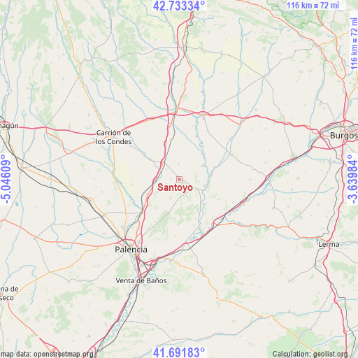
| Upper-left | 42.73334°, | -5.04609° |
| Center: | 42.21473°, | -4.34296° |
| Lower-right: | 41.69183°, | -3.63984° |
| Map W x H: | 115.8×115.8 km | = 72×72mi |
| max Lat: | 43.74134° ⇑20.4% North |
| Santoyo: | 42.21473° |
| min Lat: | ⇓79.6% South 27.64134° |
| min Long | Santoyo | max Long |
| -18.00367° | -4.34296° | 4.2899° |
| W 35.7%⇐ | ⇒64.3% E |
Elevation
Elevation of Santoyo is 797 m = 2615 ft, and this is 199 m = 653 ft above average elevation for this country.
| Max E: |
1682 m = 5518 ft | 32.2% |
| Santoyo | 797 m 2615 ft | |
| Avg. | 598 m = 1962 ft | |
Min E: |
0 m = 0 ft | 67.8% |
See also: Spain elevation on elevation.city.
Geographical zone
Santoyo is located in North temperate zone (between Tropic of Cancer and the Arctic Circle). Distance of this Northern Tropic circle is 2087.9 km =1297.4 mi to South.| Distance of | km | miles | from Santoyo |
|---|---|---|---|
| North Pole | 5313.2 | 3301.5 | to North |
| Arctic Circle | 2707.3 | 1682.2 | to North |
| Tropic Cancer | 2087.9 | 1297.4 | to South |
| Equator | 4693.8 | 2916.6 | to South |


Nearby cities:
15 places around Santoyo: (largest is in red/bold)
• Amayuelas de Arriba
12 km =7.5 mi,  268°
268°
• Amusco
11.5 km =7.1 mi,  246°
246°
• Astudillo
4.7 km =2.9 mi,  120°
120°
• Boadilla del Camino
5 km =3.1 mi,  357°
357°
• Frómista
7.7 km =4.8 mi,  318°
318°
• Itero de la Vega
10.8 km =6.7 mi,  41°
41°
• Itero del Castillo
11.6 km =7.2 mi, 44°
• Marcilla de Campos
12.3 km =7.6 mi,  338°
338°
• Melgar de Yuso
8.5 km =5.3 mi,  59°
59°
• Piña de Campos
7.7 km =4.8 mi, 268°
• Población de Campos
10.6 km =6.6 mi,  305°
305°
• Requena de Campos
10.4 km =6.5 mi, 359°
• Valbuena de Pisuerga
11.4 km =7.1 mi,  132°
132°
• Villalaco
9.5 km =5.9 mi, 133°
• Villodre
8.1 km =5 mi,  92°
92°
Sources, notices
• [Note1] Compared only with cities in Spain existing in our database
• [Src1] Map data: © OpenStreetMap contributors (CC-BY-SA)
• [Src2] Other city data from geonames.org with taken over terms of usage.
• [Src3] Geographical zone / Annual Mean Temperature by Robert A. Rohde @ Wikipedia
