Itero de la Vega geodata
Itero de la Vega (Castille and León) is a seat of a third-order administrative division; located in Spain in Europe/Madrid (GMT+2) time zone. With population of 213 people, there are 4959 cities with bigger population in this country. Compared to other cities in Spain, 81.5% of cities are located further ↓South; 63.3% of cities are located further →East and 64.1% of cities have lower elevation than Itero de la Vega. Note1
Administrative division(s):
- Level 1: Castille and León
- Level 2: Provincia de Palencia
- Level 3: Itero de la Vega


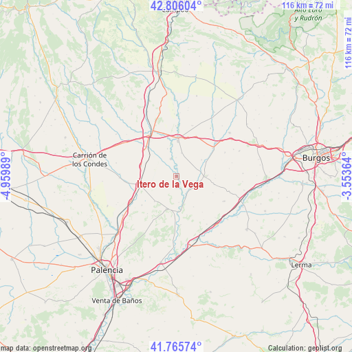
Itero de la Vega GPS coordinates[2]
42° 17' 16.944" North, 4° 15' 24.372" West
| Map corner | latitude | longitude |
|---|---|---|
| Upper-left | 42.80604°, | -4.95989° |
| Center: | 42.28804°, | -4.25677° |
| Lower-right: | 41.76574°, | -3.55364° |
| Map W x H: | 115.7×115.7 km | = 71.9×71.9mi |
| max Lat: | 43.74134° ⇑18.5% North |
| Itero de la Vega: | 42.28804° |
| min Lat: | ⇓81.5% South 27.64134° |
| min Long | Itero de la Veg | max Long |
| -18.00367° | -4.25677° | 4.2899° |
| W 36.7%⇐ | ⇒63.3% E |
Elevation
Elevation of Itero de la Vega is 772 m = 2533 ft, and this is 174 m = 571 ft above average elevation for this country.
| Max E: |
1682 m = 5518 ft | 35.9% |
| Itero de la Vega | 772 m 2533 ft | |
| Avg. | 598 m = 1962 ft | |
Min E: |
0 m = 0 ft | 64.1% |
See also: Spain elevation on elevation.city.
Geographical zone
Itero de la Vega is located in North temperate zone (between Tropic of Cancer and the Arctic Circle). Distance of this Northern Tropic circle is 2096.1 km =1302.5 mi to South.| Distance of | km | miles | from Itero de la Vega |
|---|---|---|---|
| North Pole | 5305.1 | 3296.4 | to North |
| Arctic Circle | 2699.2 | 1677.2 | to North |
| Tropic Cancer | 2096.1 | 1302.5 | to South |
| Equator | 4702 | 2921.7 | to South |


Nearby cities:
15 places around Itero de la Vega: (largest is in red/bold)
• Astudillo
11 km =6.8 mi,  196°
196°
• Boadilla del Camino
7.9 km =4.9 mi,  246°
246°
• Castrogeriz
9.7 km =6 mi,  89°
89°
• Frómista
12.5 km =7.8 mi,  259°
259°
• Itero del Castillo
1 km =0.6 mi,  78°
78°
• Lantadilla
6.1 km =3.8 mi,  342°
342°
• Marcilla de Campos
12 km =7.5 mi,  285°
285°
• Melgar de Fernamental
13 km =8.1 mi,  4°
4°
• Melgar de Yuso
3.8 km =2.4 mi,  176°
176°
• Osornillo
9.6 km =6 mi, 342°
• Pedrosa del Príncipe
6.5 km =4 mi,  132°
132°
• Requena de Campos
7.4 km =4.6 mi, 287°
• Santoyo
10.8 km =6.7 mi,  221°
221°
• Villaquirán de la Puebla
12.9 km =8 mi, 92°
• Villodre
8.6 km =5.3 mi,  173°
173°
Sources, notices
• [Note1] Compared only with cities in Spain existing in our database
• [Src1] Map data: © OpenStreetMap contributors (CC-BY-SA)
• [Src2] Other city data from geonames.org with taken over terms of usage.
• [Src3] Geographical zone / Annual Mean Temperature by Robert A. Rohde @ Wikipedia
