Santibáñez de Ecla geodata
Santibáñez de Ecla (Castille and León) is a seat of a third-order administrative division; located in Spain in Europe/Madrid (GMT+2) time zone. With population of 82 people, there are 6113 cities with bigger population in this country. Compared to other cities in Spain, 91.6% of cities are located further ↓South; 64.6% of cities are located further →East and 85.1% of cities have lower elevation than Santibáñez de Ecla. Note1
Administrative division(s):
- Level 1: Castille and León
- Level 2: Provincia de Palencia
- Level 3: Santibáñez de Ecla


Santibáñez de Ecla GPS coordinates[2]
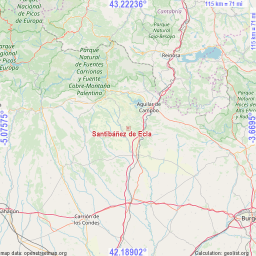
42° 42' 28.224" North, 4° 22' 21.468" West
| Map corner | latitude | longitude |
|---|---|---|
| Upper-left | 43.22236°, | -5.07575° |
| Center: | 42.70784°, | -4.37263° |
| Lower-right: | 42.18902°, | -3.6695° |
| Map W x H: | 114.9×114.9 km | = 71.4×71.4mi |
| max Lat: | 43.74134° ⇑8.4% North |
| Santibáñez de Ecla: | 42.70784° |
| min Lat: | ⇓91.6% South 27.64134° |
| min Long | Santibáñez de | max Long |
| -18.00367° | -4.37263° | 4.2899° |
| W 35.4%⇐ | ⇒64.6% E |
Elevation
Elevation of Santibáñez de Ecla is 952 m = 3123 ft, and this is 354 m = 1161 ft above average elevation for this country.
| Max E: |
1682 m = 5518 ft | 14.9% |
| Santibáñez de Ecla | 952 m 3123 ft | |
| Avg. | 598 m = 1962 ft | |
Min E: |
0 m = 0 ft | 85.1% |
See also: Spain elevation on elevation.city.
Geographical zone
Santibáñez de Ecla is located in North temperate zone (between Tropic of Cancer and the Arctic Circle). Distance of this Northern Tropic circle is 2142.7 km =1331.4 mi to South.| Distance of | km | miles | from Santibáñez de Ecla |
|---|---|---|---|
| North Pole | 5258.4 | 3267.4 | to North |
| Arctic Circle | 2652.5 | 1648.2 | to North |
| Tropic Cancer | 2142.7 | 1331.4 | to South |
| Equator | 4748.7 | 2950.7 | to South |


Nearby cities:
15 places around Santibáñez de Ecla: (largest is in red/bold)
• Aguilar de Campoo
13.4 km =8.3 mi,  43°
43°
• Alar del Rey
7.2 km =4.5 mi,  137°
137°
• Báscones de Ojeda
13.3 km =8.3 mi,  251°
251°
• Collazos de Boedo
13.3 km =8.3 mi,  222°
222°
• Dehesa de Romanos
9.2 km =5.7 mi,  213°
213°
• Herrera de Pisuerga
13 km =8.1 mi,  164°
164°
• Micieces de Ojeda
7.5 km =4.7 mi,  255°
255°
• Olea de Boedo
12.6 km =7.8 mi, 210°
• Olmos de Ojeda
4.5 km =2.8 mi,  291°
291°
• Payo de Ojeda
8.7 km =5.4 mi,  277°
277°
• Prádanos de Ojeda
3.6 km =2.2 mi, 143°
• Páramo de Boedo
14.6 km =9.1 mi,  188°
188°
• Rebolledo de la Torre
12.1 km =7.5 mi,  99°
99°
• Revilla de Collazos
13.8 km =8.6 mi,  230°
230°
• Sotobañado y Priorato
14.3 km =8.9 mi,  203°
203°
Sources, notices
• [Note1] Compared only with cities in Spain existing in our database
• [Src1] Map data: © OpenStreetMap contributors (CC-BY-SA)
• [Src2] Other city data from geonames.org with taken over terms of usage.
• [Src3] Geographical zone / Annual Mean Temperature by Robert A. Rohde @ Wikipedia
