Rebolledo de la Torre geodata
Rebolledo de la Torre (Castille and León) is a seat of a third-order administrative division; located in Spain in Europe/Madrid (GMT+2) time zone. With population of 168 people, there are 5281 cities with bigger population in this country. Compared to other cities in Spain, 91.3% of cities are located further ↓South; 62.9% of cities are located further →East and 85.4% of cities have lower elevation than Rebolledo de la Torre. Note1
Administrative division(s):
- Level 1: Castille and León
- Level 2: Provincia de Burgos
- Level 3: Rebolledo de la Torre
Current local time in Rebolledo de la Torre:
09:35 PM, ThursdayDifference from your time zone: hours


Rebolledo de la Torre GPS coordinates[2]
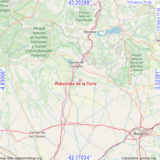
42° 41' 21.516" North, 4° 13' 36.948" West
| Map corner | latitude | longitude |
|---|---|---|
| Upper-left | 43.20398°, | -4.93006° |
| Center: | 42.68931°, | -4.22693° |
| Lower-right: | 42.17034°, | -3.52381° |
| Map W x H: | 114.9×114.9 km | = 71.4×71.4mi |
| max Lat: | 43.74134° ⇑8.7% North |
| Rebolledo de la Torre: | 42.68931° |
| min Lat: | ⇓91.3% South 27.64134° |
| min Long | Rebolledo de la | max Long |
| -18.00367° | -4.22693° | 4.2899° |
| W 37.1%⇐ | ⇒62.9% E |
Elevation
Elevation of Rebolledo de la Torre is 956 m = 3136 ft, and this is 358 m = 1175 ft above average elevation for this country.
| Max E: |
1682 m = 5518 ft | 14.6% |
| Rebolledo de la Torre | 956 m 3136 ft | |
| Avg. | 598 m = 1962 ft | |
Min E: |
0 m = 0 ft | 85.4% |
See also: Spain elevation on elevation.city.
Geographical zone
Rebolledo de la Torre is located in North temperate zone (between Tropic of Cancer and the Arctic Circle). Distance of this Northern Tropic circle is 2140.7 km =1330.2 mi to South.| Distance of | km | miles | from Rebolledo de la Torre |
|---|---|---|---|
| North Pole | 5260.5 | 3268.7 | to North |
| Arctic Circle | 2654.6 | 1649.5 | to North |
| Tropic Cancer | 2140.7 | 1330.2 | to South |
| Equator | 4746.6 | 2949.4 | to South |


Nearby cities:
15 places around Rebolledo de la Torre: (largest is in red/bold)
• Aguilar de Campoo
12 km =7.5 mi,  347°
347°
• Alar del Rey
7.7 km =4.8 mi,  245°
245°
• Berzosilla
18.5 km =11.5 mi,  56°
56°
• Calahorra de Boedo
18.2 km =11.3 mi,  225°
225°
• Dehesa de Romanos
17.9 km =11.1 mi, 251°
• Herrera de Pisuerga
13.5 km =8.4 mi,  218°
218°
• Humada
12 km =7.5 mi,  102°
102°
• Micieces de Ojeda
19.2 km =11.9 mi,  270°
270°
• Olmos de Ojeda
16.6 km =10.3 mi,  282°
282°
• Pomar de Valdivia
10.6 km =6.6 mi,  27°
27°
• Prádanos de Ojeda
9.8 km =6.1 mi,  264°
264°
• Páramo de Boedo
18.8 km =11.7 mi, 229°
• Rezmondo
19.3 km =12 mi,  182°
182°
• Santibáñez de Ecla
12.1 km =7.5 mi, 279°
• Sotresgudo
12.9 km =8 mi,  161°
161°
Sources, notices
• [Note1] Compared only with cities in Spain existing in our database
• [Src1] Map data: © OpenStreetMap contributors (CC-BY-SA)
• [Src2] Other city data from geonames.org with taken over terms of usage.
• [Src3] Geographical zone / Annual Mean Temperature by Robert A. Rohde @ Wikipedia
