Sotresgudo geodata
Sotresgudo (Castille and León) is a seat of a third-order administrative division; located in Spain in Europe/Madrid (GMT+2) time zone. With population of 626 people, there are 3554 cities with bigger population in this country. Compared to other cities in Spain, 89% of cities are located further ↓South; 62.3% of cities are located further →East and 77.2% of cities have lower elevation than Sotresgudo. Note1
Administrative division(s):
- Level 1: Castille and León
- Level 2: Provincia de Burgos
- Level 3: Sotresgudo


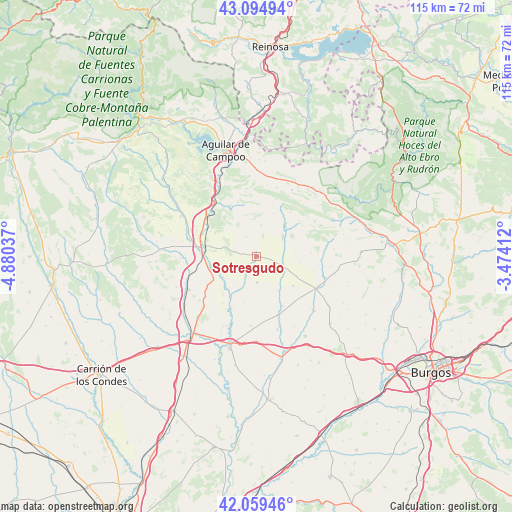
Sotresgudo GPS coordinates[2]
42° 34' 45.66" North, 4° 10' 38.1" West
| Map corner | latitude | longitude |
|---|---|---|
| Upper-left | 43.09494°, | -4.88037° |
| Center: | 42.57935°, | -4.17725° |
| Lower-right: | 42.05946°, | -3.47412° |
| Map W x H: | 115.1×115.1 km | = 71.5×71.5mi |
| max Lat: | 43.74134° ⇑11% North |
| Sotresgudo: | 42.57935° |
| min Lat: | ⇓89% South 27.64134° |
| min Long | Sotresgudo | max Long |
| -18.00367° | -4.17725° | 4.2899° |
| W 37.7%⇐ | ⇒62.3% E |
Elevation
Elevation of Sotresgudo is 872 m = 2861 ft, and this is 274 m = 899 ft above average elevation for this country.
| Max E: |
1682 m = 5518 ft | 22.8% |
| Sotresgudo | 872 m 2861 ft | |
| Avg. | 598 m = 1962 ft | |
Min E: |
0 m = 0 ft | 77.2% |
See also: Spain elevation on elevation.city.
Geographical zone
Sotresgudo is located in North temperate zone (between Tropic of Cancer and the Arctic Circle). Distance of this Northern Tropic circle is 2128.5 km =1322.6 mi to South.| Distance of | km | miles | from Sotresgudo |
|---|---|---|---|
| North Pole | 5272.7 | 3276.3 | to North |
| Arctic Circle | 2666.8 | 1657.1 | to North |
| Tropic Cancer | 2128.5 | 1322.6 | to South |
| Equator | 4734.4 | 2941.8 | to South |


Nearby cities:
15 places around Sotresgudo: (largest is in red/bold)
• Alar del Rey
14.3 km =8.9 mi,  309°
309°
• Calahorra de Boedo
17 km =10.6 mi,  268°
268°
• Grijalba
17.3 km =10.7 mi,  163°
163°
• Herrera de Pisuerga
12.7 km =7.9 mi,  277°
277°
• Humada
12.4 km =7.7 mi,  38°
38°
• Padilla de Arriba
15.8 km =9.8 mi,  184°
184°
• Prádanos de Ojeda
17.9 km =11.1 mi, 309°
• Rebolledo de la Torre
12.9 km =8 mi,  341°
341°
• Rezmondo
8.7 km =5.4 mi,  215°
215°
• San Cristóbal de Boedo
15 km =9.3 mi,  253°
253°
• Santa Cruz de Boedo
17.2 km =10.7 mi, 249°
• Sordillos
14.3 km =8.9 mi, 156°
• Villadiego
15.4 km =9.6 mi,  117°
117°
• Villamayor de Treviño
14 km =8.7 mi, 160°
• Villegas
18 km =11.2 mi,  133°
133°
Sources, notices
• [Note1] Compared only with cities in Spain existing in our database
• [Src1] Map data: © OpenStreetMap contributors (CC-BY-SA)
• [Src2] Other city data from geonames.org with taken over terms of usage.
• [Src3] Geographical zone / Annual Mean Temperature by Robert A. Rohde @ Wikipedia
