Majaelrayo geodata
Majaelrayo (Castille-La Mancha) is a seat of a third-order administrative division; located in Spain in Europe/Madrid (GMT+2) time zone. With population of 74 people, there are 6204 cities with bigger population in this country. Compared to other cities in Spain, 51.2% of cities are located further ↓South; 50.4% of cities are located further ←West and 96.4% of cities have lower elevation than Majaelrayo. Note1
Administrative division(s):
- Level 1: Castille-La Mancha
- Level 2: Provincia de Guadalajara
- Level 3: Majaelrayo


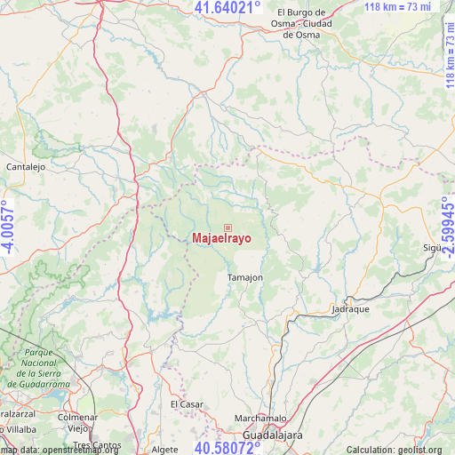
Majaelrayo GPS coordinates[2]
41° 6' 45.36" North, 3° 18' 9.252" West
| Map corner | latitude | longitude |
|---|---|---|
| Upper-left | 41.64021°, | -4.0057° |
| Center: | 41.1126°, | -3.30257° |
| Lower-right: | 40.58072°, | -2.59945° |
| Map W x H: | 117.8×117.8 km | = 73.2×73.2mi |
| max Lat: | 43.74134° ⇑48.8% North |
| Majaelrayo: | 41.1126° |
| min Lat: | ⇓51.2% South 27.64134° |
| min Long | Majaelrayo | max Long |
| -18.00367° | -3.30257° | 4.2899° |
| W 50.4%⇐ | ⇒49.6% E |
Elevation
Elevation of Majaelrayo is 1187 m = 3894 ft, and this is 589 m = 1932 ft above average elevation for this country.
| Max E: |
1682 m = 5518 ft | 3.6% |
| Majaelrayo | 1187 m 3894 ft | |
| Avg. | 598 m = 1962 ft | |
Min E: |
0 m = 0 ft | 96.4% |
See also: Spain elevation on elevation.city.
Geographical zone
Majaelrayo is located in North temperate zone (between Tropic of Cancer and the Arctic Circle). Distance of this Northern Tropic circle is 1965.4 km =1221.2 mi to South.| Distance of | km | miles | from Majaelrayo |
|---|---|---|---|
| North Pole | 5435.8 | 3377.6 | to North |
| Arctic Circle | 2829.9 | 1758.4 | to North |
| Tropic Cancer | 1965.4 | 1221.2 | to South |
| Equator | 4571.3 | 2840.5 | to South |


Nearby cities:
15 places around Majaelrayo: (largest is in red/bold)
• Arroyo de las Fraguas
14.5 km =9 mi,  94°
94°
• Bustares
19.9 km =12.4 mi,  83°
83°
• Campillo de Ranas
3.1 km =1.9 mi,  198°
198°
• Cantalojas
14.4 km =8.9 mi,  19°
19°
• Condemios de Abajo
20.5 km =12.7 mi,  55°
55°
• Condemios de Arriba
18.8 km =11.7 mi,  52°
52°
• Galve de Sorbe
15.3 km =9.5 mi,  40°
40°
• Horcajuelo de la Sierra
21.2 km =13.2 mi,  254°
254°
• Montejo de la Sierra
19.9 km =12.4 mi, 252°
• Retiendas
16.2 km =10.1 mi,  171°
171°
• Semillas
16.5 km =10.3 mi,  111°
111°
• Tamajón
13.4 km =8.3 mi,  159°
159°
• Tortuero
20.2 km =12.6 mi,  191°
191°
• Valdesotos
17.6 km =10.9 mi, 186°
• Valverde de los Arroyos
6.1 km =3.8 mi,  72°
72°
Sources, notices
• [Note1] Compared only with cities in Spain existing in our database
• [Src1] Map data: © OpenStreetMap contributors (CC-BY-SA)
• [Src2] Other city data from geonames.org with taken over terms of usage.
• [Src3] Geographical zone / Annual Mean Temperature by Robert A. Rohde @ Wikipedia
