Semillas geodata
Semillas (Castille-La Mancha) is a seat of a third-order administrative division; located in Spain in Europe/Madrid (GMT+2) time zone. With population of 52 people, there are 6440 cities with bigger population in this country. Compared to other cities in Spain, 50.1% of cities are located further ↑North; 52.5% of cities are located further ←West and 96.9% of cities have lower elevation than Semillas. Note1
Administrative division(s):
- Level 1: Castille-La Mancha
- Level 2: Provincia de Guadalajara
- Level 3: Semillas


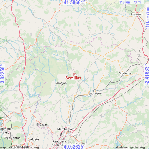
Semillas GPS coordinates[2]
41° 3' 30.852" North, 3° 7' 10.02" West
| Map corner | latitude | longitude |
|---|---|---|
| Upper-left | 41.58661°, | -3.82258° |
| Center: | 41.05857°, | -3.11945° |
| Lower-right: | 40.52625°, | -2.41633° |
| Map W x H: | 117.9×117.9 km | = 73.3×73.3mi |
| max Lat: | 43.74134° ⇑50.1% North |
| Semillas: | 41.05857° |
| min Lat: | ⇓49.9% South 27.64134° |
| min Long | Semillas | max Long |
| -18.00367° | -3.11945° | 4.2899° |
| W 52.5%⇐ | ⇒47.5% E |
Elevation
Elevation of Semillas is 1201 m = 3940 ft, and this is 603 m = 1978 ft above average elevation for this country.
| Max E: |
1682 m = 5518 ft | 3.1% |
| Semillas | 1201 m 3940 ft | |
| Avg. | 598 m = 1962 ft | |
Min E: |
0 m = 0 ft | 96.9% |
See also: Spain elevation on elevation.city.
Geographical zone
Semillas is located in North temperate zone (between Tropic of Cancer and the Arctic Circle). Distance of this Northern Tropic circle is 1959.4 km =1217.5 mi to South.| Distance of | km | miles | from Semillas |
|---|---|---|---|
| North Pole | 5441.8 | 3381.4 | to North |
| Arctic Circle | 2835.9 | 1762.1 | to North |
| Tropic Cancer | 1959.4 | 1217.5 | to South |
| Equator | 4565.3 | 2836.7 | to South |


Nearby cities:
15 places around Semillas: (largest is in red/bold)
• Arbancón
10.5 km =6.5 mi,  177°
177°
• Arroyo de las Fraguas
5 km =3.1 mi,  349°
349°
• Bustares
9.4 km =5.8 mi,  28°
28°
• Cogolludo
12.7 km =7.9 mi,  168°
168°
• Congostrina
11.5 km =7.1 mi,  101°
101°
• Fuencemillán
15.4 km =9.6 mi, 173°
• Gascueña de Bornova
12.5 km =7.8 mi,  42°
42°
• Hiendelaencina
10.1 km =6.3 mi,  73°
73°
• Monasterio
8.3 km =5.2 mi, 167°
• Pinilla de Jadraque
15.4 km =9.6 mi,  106°
106°
• San Andrés del Congosto
10.5 km =6.5 mi,  130°
130°
• Tamajón
12.6 km =7.8 mi,  238°
238°
• Valverde de los Arroyos
12.4 km =7.7 mi,  309°
309°
• Villares de Jadraque
9.2 km =5.7 mi,  58°
58°
• Zarzuela de Jadraque
6.4 km =4 mi,  80°
80°
Sources, notices
• [Note1] Compared only with cities in Spain existing in our database
• [Src1] Map data: © OpenStreetMap contributors (CC-BY-SA)
• [Src2] Other city data from geonames.org with taken over terms of usage.
• [Src3] Geographical zone / Annual Mean Temperature by Robert A. Rohde @ Wikipedia
