Maderuelo geodata
Maderuelo (Castille and León) is a seat of a third-order administrative division; located in Spain in Europe/Madrid (GMT+2) time zone. With population of 141 people, there are 5493 cities with bigger population in this country. Compared to other cities in Spain, 60.5% of cities are located further ↓South; 52.6% of cities are located further →East and 85.5% of cities have lower elevation than Maderuelo. Note1
Administrative division(s):
- Level 1: Castille and León
- Level 2: Provincia de Segovia
- Level 3: Maderuelo


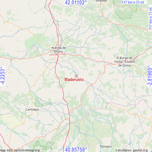
Maderuelo GPS coordinates[2]
41° 29' 11.184" North, 3° 31' 19.848" West
| Map corner | latitude | longitude |
|---|---|---|
| Upper-left | 42.01102°, | -4.2253° |
| Center: | 41.48644°, | -3.52218° |
| Lower-right: | 40.95758°, | -2.81905° |
| Map W x H: | 117.1×117.1 km | = 72.8×72.8mi |
| max Lat: | 43.74134° ⇑39.5% North |
| Maderuelo: | 41.48644° |
| min Lat: | ⇓60.5% South 27.64134° |
| min Long | Maderuelo | max Long |
| -18.00367° | -3.52218° | 4.2899° |
| W 47.4%⇐ | ⇒52.6% E |
Elevation
Elevation of Maderuelo is 958 m = 3143 ft, and this is 360 m = 1181 ft above average elevation for this country.
| Max E: |
1682 m = 5518 ft | 14.5% |
| Maderuelo | 958 m 3143 ft | |
| Avg. | 598 m = 1962 ft | |
Min E: |
0 m = 0 ft | 85.5% |
See also: Spain elevation on elevation.city.
Geographical zone
Maderuelo is located in North temperate zone (between Tropic of Cancer and the Arctic Circle). Distance of this Northern Tropic circle is 2006.9 km =1247 mi to South.| Distance of | km | miles | from Maderuelo |
|---|---|---|---|
| North Pole | 5394.2 | 3351.8 | to North |
| Arctic Circle | 2788.3 | 1732.6 | to North |
| Tropic Cancer | 2006.9 | 1247 | to South |
| Equator | 4612.9 | 2866.3 | to South |


Nearby cities:
15 places around Maderuelo: (largest is in red/bold)
• Alconada de Maderuelo
5.1 km =3.2 mi,  142°
142°
• Aldealengua de Santa María
5.3 km =3.3 mi,  120°
120°
• Bercimuel
10.5 km =6.5 mi,  202°
202°
• Campo de San Pedro
6.6 km =4.1 mi, 197°
• Castillejo de Robledo
8.3 km =5.2 mi,  14°
14°
• Cedillo de la Torre
9.8 km =6.1 mi,  225°
225°
• Cilleruelo de San Mamés
7.1 km =4.4 mi,  211°
211°
• Corral de Ayllón
11.9 km =7.4 mi,  153°
153°
• Fresno de Cantespino
13.3 km =8.3 mi,  171°
171°
• Languilla
9.1 km =5.7 mi, 116°
• Montejo de la Vega de la Serrezuela
13.1 km =8.1 mi,  302°
302°
• Pajarejos
12.1 km =7.5 mi, 207°
• Riaguas de San Bartolomé
7.2 km =4.5 mi,  157°
157°
• Valdevacas de Montejo
10.2 km =6.3 mi,  291°
291°
• Villaverde de Montejo
11.7 km =7.3 mi, 289°
Sources, notices
• [Note1] Compared only with cities in Spain existing in our database
• [Src1] Map data: © OpenStreetMap contributors (CC-BY-SA)
• [Src2] Other city data from geonames.org with taken over terms of usage.
• [Src3] Geographical zone / Annual Mean Temperature by Robert A. Rohde @ Wikipedia
