Castillejo de Robledo geodata
Castillejo de Robledo (Castille and León) is a seat of a third-order administrative division; located in Spain in Europe/Madrid (GMT+2) time zone. With population of 148 people, there are 5444 cities with bigger population in this country. Compared to other cities in Spain, 62.4% of cities are located further ↓South; 52.1% of cities are located further →East and 85.7% of cities have lower elevation than Castillejo de Robledo. Note1
Administrative division(s):
- Level 1: Castille and León
- Level 2: Provincia de Soria
- Level 3: Castillejo de Robledo


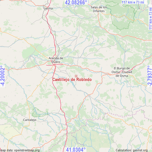
Castillejo de Robledo GPS coordinates[2]
41° 33' 31.212" North, 3° 29' 48.804" West
| Map corner | latitude | longitude |
|---|---|---|
| Upper-left | 42.08266°, | -4.20002° |
| Center: | 41.55867°, | -3.49689° |
| Lower-right: | 41.0304°, | -2.79377° |
| Map W x H: | 117×117 km | = 72.7×72.7mi |
| max Lat: | 43.74134° ⇑37.6% North |
| Castillejo de Robledo: | 41.55867° |
| min Lat: | ⇓62.4% South 27.64134° |
| min Long | Castillejo de R | max Long |
| -18.00367° | -3.49689° | 4.2899° |
| W 47.9%⇐ | ⇒52.1% E |
Elevation
Elevation of Castillejo de Robledo is 960 m = 3150 ft, and this is 362 m = 1188 ft above average elevation for this country.
| Max E: |
1682 m = 5518 ft | 14.3% |
| Castillejo de Robledo | 960 m 3150 ft | |
| Avg. | 598 m = 1962 ft | |
Min E: |
0 m = 0 ft | 85.7% |
See also: Spain elevation on elevation.city.
Geographical zone
Castillejo de Robledo is located in North temperate zone (between Tropic of Cancer and the Arctic Circle). Distance of this Northern Tropic circle is 2015 km =1252.1 mi to South.| Distance of | km | miles | from Castillejo de Robledo |
|---|---|---|---|
| North Pole | 5386.2 | 3346.8 | to North |
| Arctic Circle | 2780.3 | 1727.6 | to North |
| Tropic Cancer | 2015 | 1252.1 | to South |
| Equator | 4620.9 | 2871.3 | to South |


Nearby cities:
15 places around Castillejo de Robledo: (largest is in red/bold)
• Alconada de Maderuelo
12.1 km =7.5 mi,  175°
175°
• Aldealengua de Santa María
11 km =6.8 mi,  167°
167°
• Fuentelcésped
12.5 km =7.8 mi,  287°
287°
• Langa de Duero
9.8 km =6.1 mi,  54°
54°
• Languilla
13.6 km =8.5 mi,  153°
153°
• Maderuelo
8.3 km =5.2 mi,  194°
194°
• Miño de San Esteban
12.8 km =8 mi,  101°
101°
• Montejo de la Vega de la Serrezuela
13.1 km =8.1 mi,  265°
265°
• Peñaranda de Duero
14.5 km =9 mi,  6°
6°
• Riaguas de San Bartolomé
14.7 km =9.1 mi, 177°
• San Juan del Monte
14 km =8.7 mi,  350°
350°
• Santa Cruz de la Salceda
9 km =5.6 mi,  297°
297°
• Vadocondes
11 km =6.8 mi,  324°
324°
• Valdevacas de Montejo
12.3 km =7.6 mi,  249°
249°
• Villaverde de Montejo
13.7 km =8.5 mi, 252°
Sources, notices
• [Note1] Compared only with cities in Spain existing in our database
• [Src1] Map data: © OpenStreetMap contributors (CC-BY-SA)
• [Src2] Other city data from geonames.org with taken over terms of usage.
• [Src3] Geographical zone / Annual Mean Temperature by Robert A. Rohde @ Wikipedia
