Cedillo de la Torre geodata
Cedillo de la Torre (Castille and León) is a seat of a third-order administrative division; located in Spain in Europe/Madrid (GMT+2) time zone. With population of 105 people, there are 5867 cities with bigger population in this country. Compared to other cities in Spain, 58.7% of cities are located further ↓South; 53.8% of cities are located further →East and 89.6% of cities have lower elevation than Cedillo de la Torre. Note1
Administrative division(s):
- Level 1: Castille and León
- Level 2: Provincia de Segovia
- Level 3: Cedillo de la Torre


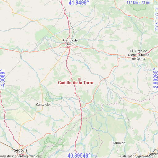
Cedillo de la Torre GPS coordinates[2]
41° 25' 29.352" North, 3° 36' 20.772" West
| Map corner | latitude | longitude |
|---|---|---|
| Upper-left | 41.9499°, | -4.3089° |
| Center: | 41.42482°, | -3.60577° |
| Lower-right: | 40.89546°, | -2.90265° |
| Map W x H: | 117.2×117.2 km | = 72.8×72.8mi |
| max Lat: | 43.74134° ⇑41.3% North |
| Cedillo de la Torre: | 41.42482° |
| min Lat: | ⇓58.7% South 27.64134° |
| min Long | Cedillo de la T | max Long |
| -18.00367° | -3.60577° | 4.2899° |
| W 46.2%⇐ | ⇒53.8% E |
Elevation
Elevation of Cedillo de la Torre is 1024 m = 3360 ft, and this is 426 m = 1398 ft above average elevation for this country.
| Max E: |
1682 m = 5518 ft | 10.4% |
| Cedillo de la Torre | 1024 m 3360 ft | |
| Avg. | 598 m = 1962 ft | |
Min E: |
0 m = 0 ft | 89.6% |
See also: Spain elevation on elevation.city.
Geographical zone
Cedillo de la Torre is located in North temperate zone (between Tropic of Cancer and the Arctic Circle). Distance of this Northern Tropic circle is 2000.1 km =1242.8 mi to South.| Distance of | km | miles | from Cedillo de la Torre |
|---|---|---|---|
| North Pole | 5401.1 | 3356.1 | to North |
| Arctic Circle | 2795.2 | 1736.9 | to North |
| Tropic Cancer | 2000.1 | 1242.8 | to South |
| Equator | 4606 | 2862 | to South |


Nearby cities:
15 places around Cedillo de la Torre: (largest is in red/bold)
• Alconada de Maderuelo
10.4 km =6.5 mi,  74°
74°
• Aldeonte
10.2 km =6.3 mi,  216°
216°
• Bercimuel
4.1 km =2.5 mi,  134°
134°
• Boceguillas
10.2 km =6.3 mi,  195°
195°
• Campo de San Pedro
5 km =3.1 mi,  83°
83°
• Cilleruelo de San Mamés
3.4 km =2.1 mi, 76°
• Encinas
7.6 km =4.7 mi, 223°
• Fresno de la Fuente
4.9 km =3 mi, 222°
• Grajera
5.8 km =3.6 mi,  186°
186°
• Maderuelo
9.8 km =6.1 mi,  45°
45°
• Navares de Ayuso
10.2 km =6.3 mi,  236°
236°
• Pajarejos
4.1 km =2.5 mi,  161°
161°
• Pradales
9.1 km =5.7 mi,  291°
291°
• Riaguas de San Bartolomé
9.7 km =6 mi,  88°
88°
• Sequera de Fresno
8.2 km =5.1 mi,  142°
142°
Sources, notices
• [Note1] Compared only with cities in Spain existing in our database
• [Src1] Map data: © OpenStreetMap contributors (CC-BY-SA)
• [Src2] Other city data from geonames.org with taken over terms of usage.
• [Src3] Geographical zone / Annual Mean Temperature by Robert A. Rohde @ Wikipedia
