Llardecáns geodata
Llardecáns (Catalonia) is a populated place; located in Spain in Europe/Madrid (GMT+2) time zone. With population of 572 people, there are 3674 cities with bigger population in this country. Compared to other cities in Spain, 56.9% of cities are located further ↓South; 89.2% of cities are located further ←West and 69.2% of cities have higher elevation than Llardecáns. Note1


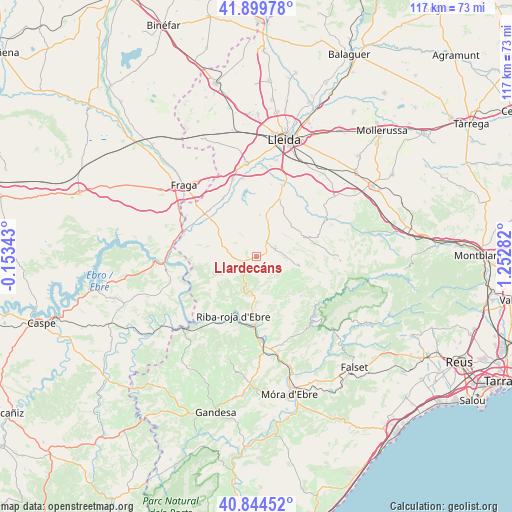
Llardecáns GPS coordinates[2]
41° 22' 27.444" North, 0° 32' 58.884" East
| Map corner | latitude | longitude |
|---|---|---|
| Upper-left | 41.89978°, | -0.15343° |
| Center: | 41.37429°, | 0.54969° |
| Lower-right: | 40.84452°, | 1.25282° |
| Map W x H: | 117.3×117.3 km | = 72.9×72.9mi |
| max Lat: | 43.74134° ⇑43.1% North |
| Llardecáns: | 41.37429° |
| min Lat: | ⇓56.9% South 27.64134° |
| min Long | Llardecáns | max Long |
| -18.00367° | 0.54969° | 4.2899° |
| W 89.2%⇐ | ⇒10.8% E |
Elevation
Elevation of Llardecáns is 396 m = 1299 ft, and this is 202 m = 663 ft below average elevation for this country.
| Max E: |
1682 m = 5518 ft | 69.2% |
| Avg. | 598 m = 1962 ft | |
| Llardecáns | 396 m = 1299 ft | |
Min E: |
0 m = 0 ft | 30.8% |
See also: Spain elevation on elevation.city.
Geographical zone
Llardecáns is located in North temperate zone (between Tropic of Cancer and the Arctic Circle). Distance of this Northern Tropic circle is 1994.5 km =1239.3 mi to South.| Distance of | km | miles | from Llardecáns |
|---|---|---|---|
| North Pole | 5406.7 | 3359.6 | to North |
| Arctic Circle | 2800.8 | 1740.3 | to North |
| Tropic Cancer | 1994.5 | 1239.3 | to South |
| Equator | 4600.4 | 2858.6 | to South |


Nearby cities:
15 places around Llardecáns: (largest is in red/bold)
• Aitona
14 km =8.7 mi,  330°
330°
• Alcanó
13.1 km =8.1 mi,  25°
25°
• Alfés
17.4 km =10.8 mi,  19°
19°
• Aspa
16.9 km =10.5 mi,  37°
37°
• Bovera
10.5 km =6.5 mi,  127°
127°
• Flix
16 km =9.9 mi,  179°
179°
• Maials
4.2 km =2.6 mi,  258°
258°
• Seròs
15.1 km =9.4 mi,  312°
312°
• Soses
18.5 km =11.5 mi,  342°
342°
• Sunyer
16.9 km =10.5 mi,  12°
12°
• Torrebesses
7.8 km =4.8 mi, 32°
• Torres de Segre
18 km =11.2 mi,  350°
350°
• el Cogul
15.2 km =9.4 mi,  47°
47°
• la Granadella
10.1 km =6.3 mi,  105°
105°
• la Granja d'Escarp
16 km =9.9 mi,  287°
287°
Sources, notices
• [Note1] Compared only with cities in Spain existing in our database
• [Src1] Map data: © OpenStreetMap contributors (CC-BY-SA)
• [Src2] Other city data from geonames.org with taken over terms of usage.
• [Src3] Geographical zone / Annual Mean Temperature by Robert A. Rohde @ Wikipedia
