Sunyer geodata
Sunyer (Catalonia) is a seat of a third-order administrative division; located in Spain in Europe/Madrid (GMT+2) time zone. In our database, there are 6762 cities with bigger population. Compared to other cities in Spain, 61.3% of cities are located further ↓South; 89.3% of cities are located further ←West and 82.6% of cities have higher elevation than Sunyer. Note1


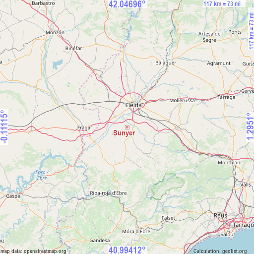
Sunyer GPS coordinates[2]
41° 31' 21.648" North, 0° 35' 31.092" East
| Map corner | latitude | longitude |
|---|---|---|
| Upper-left | 42.04696°, | -0.11115° |
| Center: | 41.52268°, | 0.59197° |
| Lower-right: | 40.99412°, | 1.2951° |
| Map W x H: | 117.1×117.1 km | = 72.8×72.8mi |
| max Lat: | 43.74134° ⇑38.7% North |
| Sunyer: | 41.52268° |
| min Lat: | ⇓61.3% South 27.64134° |
| min Long | Sunyer | max Long |
| -18.00367° | 0.59197° | 4.2899° |
| W 89.3%⇐ | ⇒10.7% E |
Elevation
Elevation of Sunyer is 174 m = 571 ft, and this is 424 m = 1391 ft below average elevation for this country.
| Max E: |
1682 m = 5518 ft | 82.6% |
| Avg. | 598 m = 1962 ft | |
| Sunyer | 174 m = 571 ft | |
Min E: |
0 m = 0 ft | 17.4% |
See also: Spain elevation on elevation.city.
Geographical zone
Sunyer is located in North temperate zone (between Tropic of Cancer and the Arctic Circle). Distance of this Northern Tropic circle is 2011 km =1249.6 mi to South.| Distance of | km | miles | from Sunyer |
|---|---|---|---|
| North Pole | 5390.2 | 3349.3 | to North |
| Arctic Circle | 2784.3 | 1730.1 | to North |
| Tropic Cancer | 2011 | 1249.6 | to South |
| Equator | 4616.9 | 2868.8 | to South |


Nearby cities:
15 places around Sunyer: (largest is in red/bold)
• Aitona
11.3 km =7 mi,  247°
247°
• Alcanó
5.1 km =3.2 mi,  156°
156°
• Alcarràs
7.9 km =4.9 mi,  307°
307°
• Alcoletge
16.3 km =10.1 mi,  31°
31°
• Alfés
2.4 km =1.5 mi,  93°
93°
• Alpicat
16.2 km =10.1 mi,  349°
349°
• Aspa
7.4 km =4.6 mi,  114°
114°
• Castelldans
14.8 km =9.2 mi,  99°
99°
• Lleida
10.8 km =6.7 mi,  13°
13°
• Seròs
15.9 km =9.9 mi, 246°
• Soses
9.1 km =5.7 mi,  277°
277°
• Sudanell
4.3 km =2.7 mi,  331°
331°
• Torrebesses
10 km =6.2 mi,  176°
176°
• Torres de Segre
6.6 km =4.1 mi, 280°
• el Cogul
9.8 km =6.1 mi,  129°
129°
Sources, notices
• [Note1] Compared only with cities in Spain existing in our database
• [Src1] Map data: © OpenStreetMap contributors (CC-BY-SA)
• [Src2] Other city data from geonames.org with taken over terms of usage.
• [Src3] Geographical zone / Annual Mean Temperature by Robert A. Rohde @ Wikipedia
