Lantadilla geodata
Lantadilla (Castille and León) is a seat of a third-order administrative division; located in Spain in Europe/Madrid (GMT+2) time zone. With population of 442 people, there are 4024 cities with bigger population in this country. Compared to other cities in Spain, 83.1% of cities are located further ↓South; 63.6% of cities are located further →East and 66.6% of cities have lower elevation than Lantadilla. Note1
Administrative division(s):
- Level 1: Castille and León
- Level 2: Provincia de Palencia
- Level 3: Lantadilla


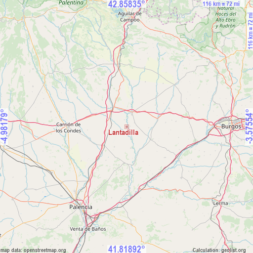
Lantadilla GPS coordinates[2]
42° 20' 26.808" North, 4° 16' 43.176" West
| Map corner | latitude | longitude |
|---|---|---|
| Upper-left | 42.85835°, | -4.98179° |
| Center: | 42.34078°, | -4.27866° |
| Lower-right: | 41.81892°, | -3.57554° |
| Map W x H: | 115.6×115.6 km | = 71.8×71.8mi |
| max Lat: | 43.74134° ⇑16.9% North |
| Lantadilla: | 42.34078° |
| min Lat: | ⇓83.1% South 27.64134° |
| min Long | Lantadilla | max Long |
| -18.00367° | -4.27866° | 4.2899° |
| W 36.4%⇐ | ⇒63.6% E |
Elevation
Elevation of Lantadilla is 789 m = 2589 ft, and this is 191 m = 627 ft above average elevation for this country.
| Max E: |
1682 m = 5518 ft | 33.4% |
| Lantadilla | 789 m 2589 ft | |
| Avg. | 598 m = 1962 ft | |
Min E: |
0 m = 0 ft | 66.6% |
See also: Spain elevation on elevation.city.
Geographical zone
Lantadilla is located in North temperate zone (between Tropic of Cancer and the Arctic Circle). Distance of this Northern Tropic circle is 2101.9 km =1306.1 mi to South.| Distance of | km | miles | from Lantadilla |
|---|---|---|---|
| North Pole | 5299.2 | 3292.8 | to North |
| Arctic Circle | 2693.3 | 1673.5 | to North |
| Tropic Cancer | 2101.9 | 1306.1 | to South |
| Equator | 4707.9 | 2925.4 | to South |


Nearby cities:
15 places around Lantadilla: (largest is in red/bold)
• Boadilla del Camino
10.6 km =6.6 mi,  211°
211°
• Castrogeriz
12.9 km =8 mi,  116°
116°
• Frómista
13.3 km =8.3 mi,  231°
231°
• Itero de la Vega
6.1 km =3.8 mi,  162°
162°
• Itero del Castillo
6.3 km =3.9 mi,  153°
153°
• Marcilla de Campos
10 km =6.2 mi,  255°
255°
• Melgar de Fernamental
7.6 km =4.7 mi,  21°
21°
• Melgar de Yuso
9.9 km =6.2 mi,  168°
168°
• Osornillo
3.5 km =2.2 mi,  342°
342°
• Padilla de Abajo
11.2 km =7 mi,  48°
48°
• Padilla de Arriba
13 km =8.1 mi,  33°
33°
• Pedrosa del Príncipe
12.1 km =7.5 mi, 147°
• Requena de Campos
6.4 km =4 mi,  235°
235°
• Villasandino
14.3 km =8.9 mi,  76°
76°
• Villodre
14.6 km =9.1 mi, 169°
Sources, notices
• [Note1] Compared only with cities in Spain existing in our database
• [Src1] Map data: © OpenStreetMap contributors (CC-BY-SA)
• [Src2] Other city data from geonames.org with taken over terms of usage.
• [Src3] Geographical zone / Annual Mean Temperature by Robert A. Rohde @ Wikipedia
