La Bóveda de Toro geodata
La Bóveda de Toro (Castille and León) is a populated place; located in Spain in Europe/Madrid (GMT+2) time zone. With population of 872 people, there are 3101 cities with bigger population in this country. Compared to other cities in Spain, 56.2% of cities are located further ↓South; 77.5% of cities are located further →East and 54.4% of cities have lower elevation than La Bóveda de Toro. Note1
Administrative division(s):
- Level 1: Castille and León
- Level 2: Provincia de Zamora
- Level 3: Bóveda de Toro, La


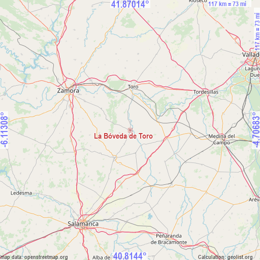
La Bóveda de Toro GPS coordinates[2]
41° 20' 39.876" North, 5° 24' 35.82" West
| Map corner | latitude | longitude |
|---|---|---|
| Upper-left | 41.87014°, | -6.11308° |
| Center: | 41.34441°, | -5.40995° |
| Lower-right: | 40.8144°, | -4.70683° |
| Map W x H: | 117.4×117.4 km | = 72.9×72.9mi |
| max Lat: | 43.74134° ⇑43.8% North |
| La Bóveda de Toro: | 41.34441° |
| min Lat: | ⇓56.2% South 27.64134° |
| min Long | La Bóveda de T | max Long |
| -18.00367° | -5.40995° | 4.2899° |
| W 22.5%⇐ | ⇒77.5% E |
Elevation
Elevation of La Bóveda de Toro is 704 m = 2310 ft, and this is 106 m = 348 ft above average elevation for this country.
| Max E: |
1682 m = 5518 ft | 45.6% |
| La Bóveda de Toro | 704 m 2310 ft | |
| Avg. | 598 m = 1962 ft | |
Min E: |
0 m = 0 ft | 54.4% |
See also: Spain elevation on elevation.city.
Geographical zone
La Bóveda de Toro is located in North temperate zone (between Tropic of Cancer and the Arctic Circle). Distance of this Northern Tropic circle is 1991.1 km =1237.2 mi to South.| Distance of | km | miles | from La Bóveda de Toro |
|---|---|---|---|
| North Pole | 5410 | 3361.6 | to North |
| Arctic Circle | 2804.1 | 1742.4 | to North |
| Tropic Cancer | 1991.1 | 1237.2 | to South |
| Equator | 4597.1 | 2856.5 | to South |


Nearby cities:
15 places around La Bóveda de Toro: (largest is in red/bold)
• Alaejos
16.7 km =10.4 mi,  104°
104°
• Argujillo
15.3 km =9.5 mi,  256°
256°
• Castrillo de la Guareña
14.5 km =9 mi,  150°
150°
• Castronuño
13.2 km =8.2 mi,  67°
67°
• Fuentelapeña
10.6 km =6.6 mi,  167°
167°
• Fuentesaúco
14.6 km =9.1 mi,  209°
209°
• Peleagonzalo
16.4 km =10.2 mi,  338°
338°
• San Miguel de la Ribera
14 km =8.7 mi, 264°
• Sanzoles
16.4 km =10.2 mi,  306°
306°
• Vadillo de la Guareña
8.4 km =5.2 mi, 145°
• Valdefinjas
12.4 km =7.7 mi, 343°
• Venialbo
11.7 km =7.3 mi,  295°
295°
• Villabuena del Puente
4 km =2.5 mi,  2°
2°
• Villaescusa
16 km =9.9 mi,  196°
196°
• Villafranca de Duero
13.4 km =8.3 mi,  42°
42°
Sources, notices
• [Note1] Compared only with cities in Spain existing in our database
• [Src1] Map data: © OpenStreetMap contributors (CC-BY-SA)
• [Src2] Other city data from geonames.org with taken over terms of usage.
• [Src3] Geographical zone / Annual Mean Temperature by Robert A. Rohde @ Wikipedia
