Fuentesaúco geodata
Fuentesaúco (Castille and León) is a seat of a third-order administrative division; located in Spain in Europe/Madrid (GMT+2) time zone. With population of 1,879 people, there are 2245 cities with bigger population in this country. Compared to other cities in Spain, 54% of cities are located further ↓South; 78.7% of cities are located further →East and 68.8% of cities have lower elevation than Fuentesaúco. Note1
Administrative division(s):
- Level 1: Castille and León
- Level 2: Provincia de Zamora
- Level 3: Fuentesaúco


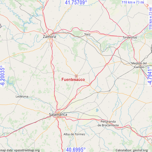
Fuentesaúco GPS coordinates[2]
41° 13' 49.548" North, 5° 29' 49.992" West
| Map corner | latitude | longitude |
|---|---|---|
| Upper-left | 41.75709°, | -6.20035° |
| Center: | 41.23043°, | -5.49722° |
| Lower-right: | 40.6995°, | -4.7941° |
| Map W x H: | 117.6×117.6 km | = 73.1×73.1mi |
| max Lat: | 43.74134° ⇑46% North |
| Fuentesaúco: | 41.23043° |
| min Lat: | ⇓54% South 27.64134° |
| min Long | Fuentesaúco | max Long |
| -18.00367° | -5.49722° | 4.2899° |
| W 21.3%⇐ | ⇒78.7% E |
Elevation
Elevation of Fuentesaúco is 804 m = 2638 ft, and this is 206 m = 676 ft above average elevation for this country.
| Max E: |
1682 m = 5518 ft | 31.2% |
| Fuentesaúco | 804 m 2638 ft | |
| Avg. | 598 m = 1962 ft | |
Min E: |
0 m = 0 ft | 68.8% |
See also: Spain elevation on elevation.city.
Geographical zone
Fuentesaúco is located in North temperate zone (between Tropic of Cancer and the Arctic Circle). Distance of this Northern Tropic circle is 1978.5 km =1229.4 mi to South.| Distance of | km | miles | from Fuentesaúco |
|---|---|---|---|
| North Pole | 5422.7 | 3369.5 | to North |
| Arctic Circle | 2816.8 | 1750.3 | to North |
| Tropic Cancer | 1978.5 | 1229.4 | to South |
| Equator | 4584.4 | 2848.6 | to South |


Nearby cities:
15 places around Fuentesaúco: (largest is in red/bold)
• Aldeanueva de Figueroa
9.4 km =5.8 mi,  193°
193°
• Argujillo
11.8 km =7.3 mi,  320°
320°
• Castrillo de la Guareña
14.4 km =8.9 mi,  90°
90°
• Cañizal
12.9 km =8 mi,  123°
123°
• Espino de la Orbada
15 km =9.3 mi,  156°
156°
• Fuentelapeña
9.8 km =6.1 mi,  76°
76°
• Fuentespreadas
15.3 km =9.5 mi,  314°
314°
• La Bóveda de Toro
14.6 km =9.1 mi,  29°
29°
• Parada de Rubiales
10.5 km =6.5 mi,  150°
150°
• San Miguel de la Ribera
13.2 km =8.2 mi,  329°
329°
• Tardáguila
14.4 km =8.9 mi,  206°
206°
• Topas
14 km =8.7 mi,  234°
234°
• Vadillo de la Guareña
13.4 km =8.3 mi,  64°
64°
• Villaescusa
3.9 km =2.4 mi,  134°
134°
• Villamor de los Escuderos
6.9 km =4.3 mi,  290°
290°
Sources, notices
• [Note1] Compared only with cities in Spain existing in our database
• [Src1] Map data: © OpenStreetMap contributors (CC-BY-SA)
• [Src2] Other city data from geonames.org with taken over terms of usage.
• [Src3] Geographical zone / Annual Mean Temperature by Robert A. Rohde @ Wikipedia
