Fuentelapeña geodata
Fuentelapeña (Castille and León) is a seat of a third-order administrative division; located in Spain in Europe/Madrid (GMT+2) time zone. With population of 920 people, there are 3050 cities with bigger population in this country. Compared to other cities in Spain, 54.4% of cities are located further ↓South; 77.2% of cities are located further →East and 59.9% of cities have lower elevation than Fuentelapeña. Note1
Administrative division(s):
- Level 1: Castille and León
- Level 2: Provincia de Zamora
- Level 3: Fuentelapeña


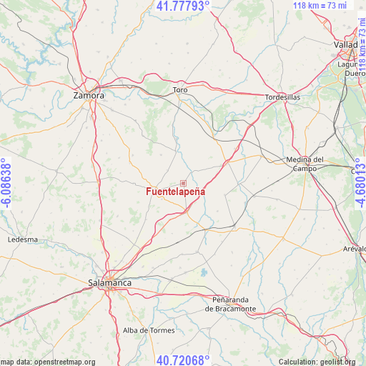
Fuentelapeña GPS coordinates[2]
41° 15' 5.184" North, 5° 22' 59.7" West
| Map corner | latitude | longitude |
|---|---|---|
| Upper-left | 41.77793°, | -6.08638° |
| Center: | 41.25144°, | -5.38325° |
| Lower-right: | 40.72068°, | -4.68013° |
| Map W x H: | 117.6×117.6 km | = 73.1×73.1mi |
| max Lat: | 43.74134° ⇑45.6% North |
| Fuentelapeña: | 41.25144° |
| min Lat: | ⇓54.4% South 27.64134° |
| min Long | Fuentelapeña | max Long |
| -18.00367° | -5.38325° | 4.2899° |
| W 22.8%⇐ | ⇒77.2% E |
Elevation
Elevation of Fuentelapeña is 744 m = 2441 ft, and this is 146 m = 479 ft above average elevation for this country.
| Max E: |
1682 m = 5518 ft | 40.1% |
| Fuentelapeña | 744 m 2441 ft | |
| Avg. | 598 m = 1962 ft | |
Min E: |
0 m = 0 ft | 59.9% |
See also: Spain elevation on elevation.city.
Geographical zone
Fuentelapeña is located in North temperate zone (between Tropic of Cancer and the Arctic Circle). Distance of this Northern Tropic circle is 1980.8 km =1230.8 mi to South.| Distance of | km | miles | from Fuentelapeña |
|---|---|---|---|
| North Pole | 5420.3 | 3368 | to North |
| Arctic Circle | 2814.4 | 1748.8 | to North |
| Tropic Cancer | 1980.8 | 1230.8 | to South |
| Equator | 4586.7 | 2850 | to South |


Nearby cities:
15 places around Fuentelapeña: (largest is in red/bold)
• Alaejos
15.3 km =9.5 mi,  66°
66°
• Aldeanueva de Figueroa
16.5 km =10.3 mi,  225°
225°
• Castrillo de la Guareña
5.4 km =3.4 mi,  115°
115°
• Cañizal
9.5 km =5.9 mi,  172°
172°
• Espino de la Orbada
16.4 km =10.2 mi,  192°
192°
• Fuentesaúco
9.8 km =6.1 mi,  256°
256°
• La Bóveda de Toro
10.6 km =6.6 mi,  347°
347°
• Parada de Rubiales
12.3 km =7.6 mi,  201°
201°
• Tarazona de Guareña
14.2 km =8.8 mi,  128°
128°
• Torrecilla de la Orden
13.8 km =8.6 mi,  105°
105°
• Vadillo de la Guareña
4.3 km =2.7 mi,  36°
36°
• Vallesa de la Guareña
13.8 km =8.6 mi,  159°
159°
• Villabuena del Puente
14.5 km =9 mi, 351°
• Villaescusa
8.4 km =5.2 mi, 233°
• Villamor de los Escuderos
16 km =9.9 mi,  270°
270°
Sources, notices
• [Note1] Compared only with cities in Spain existing in our database
• [Src1] Map data: © OpenStreetMap contributors (CC-BY-SA)
• [Src2] Other city data from geonames.org with taken over terms of usage.
• [Src3] Geographical zone / Annual Mean Temperature by Robert A. Rohde @ Wikipedia
