Irurtzun geodata
Irurtzun (Navarre) is a seat of a third-order administrative division; located in Spain in Europe/Madrid (GMT+2) time zone. In our database, there are 6762 cities with bigger population. Compared to other cities in Spain, 93.8% of cities are located further ↓South; 69.1% of cities are located further ←West and 66.3% of cities have higher elevation than Irurtzun. Note1


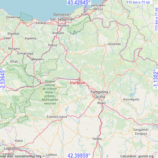
Irurtzun GPS coordinates[2]
42° 55' 0.012" North, 1° 49' 59.988" West
| Map corner | latitude | longitude |
|---|---|---|
| Upper-left | 43.42945°, | -2.53645° |
| Center: | 42.91667°, | -1.83333° |
| Lower-right: | 42.39959°, | -1.1302° |
| Map W x H: | 114.5×114.5 km | = 71.1×71.1mi |
| max Lat: | 43.74134° ⇑6.2% North |
| Irurtzun: | 42.91667° |
| min Lat: | ⇓93.8% South 27.64134° |
| min Long | Irurtzun | max Long |
| -18.00367° | -1.83333° | 4.2899° |
| W 69.1%⇐ | ⇒30.9% E |
Elevation
Elevation of Irurtzun is 443 m = 1453 ft, and this is 155 m = 509 ft below average elevation for this country.
| Max E: |
1682 m = 5518 ft | 66.3% |
| Avg. | 598 m = 1962 ft | |
| Irurtzun | 443 m = 1453 ft | |
Min E: |
0 m = 0 ft | 33.7% |
See also: Spain elevation on elevation.city.
Geographical zone
Irurtzun is located in North temperate zone (between Tropic of Cancer and the Arctic Circle). Distance of this Northern Tropic circle is 2166 km =1345.9 mi to South.| Distance of | km | miles | from Irurtzun |
|---|---|---|---|
| North Pole | 5235.2 | 3253 | to North |
| Arctic Circle | 2629.3 | 1633.8 | to North |
| Tropic Cancer | 2166 | 1345.9 | to South |
| Equator | 4771.9 | 2965.1 | to South |


Nearby cities:
15 places around Irurtzun: (largest is in red/bold)
• Arbizu
16.8 km =10.4 mi,  269°
269°
• Arruazu
13.7 km =8.5 mi, 272°
• Berriobeiti
13.2 km =8.2 mi,  124°
124°
• Berriozar
16.6 km =10.3 mi,  125°
125°
• Betelu
17 km =10.6 mi,  315°
315°
• Ciriza
14.1 km =8.8 mi,  178°
178°
• Echarri
15.2 km =9.4 mi, 177°
• Goñi
9.2 km =5.7 mi,  218°
218°
• Irañeta
9.2 km =5.7 mi, 274°
• Itza
12.3 km =7.6 mi,  136°
136°
• Lakuntza
15.5 km =9.6 mi, 272°
• Lekunberri
10.5 km =6.5 mi,  332°
332°
• Oltza
9.2 km =5.7 mi, 143°
• Orkoien
14.7 km =9.1 mi, 134°
• Salinas de Oro
16.4 km =10.2 mi,  196°
196°
Sources, notices
• [Note1] Compared only with cities in Spain existing in our database
• [Src1] Map data: © OpenStreetMap contributors (CC-BY-SA)
• [Src2] Other city data from geonames.org with taken over terms of usage.
• [Src3] Geographical zone / Annual Mean Temperature by Robert A. Rohde @ Wikipedia
