Huerta del Rey geodata
Huerta del Rey (Castille and León) is a populated place; located in Spain in Europe/Madrid (GMT+2) time zone. With population of 1,222 people, there are 2708 cities with bigger population in this country. Compared to other cities in Spain, 69.6% of cities are located further ↓South; 50.1% of cities are located further →East and 87.6% of cities have lower elevation than Huerta del Rey. Note1
Administrative division(s):
- Level 1: Castille and León
- Level 2: Provincia de Burgos
- Level 3: Arauzo de Miel


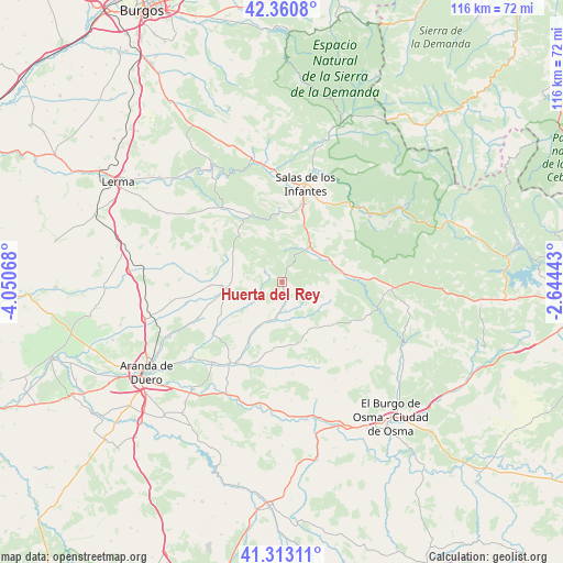
Huerta del Rey GPS coordinates[2]
41° 50' 20.76" North, 3° 20' 51.18" West
| Map corner | latitude | longitude |
|---|---|---|
| Upper-left | 42.3608°, | -4.05068° |
| Center: | 41.8391°, | -3.34755° |
| Lower-right: | 41.31311°, | -2.64443° |
| Map W x H: | 116.5×116.5 km | = 72.4×72.4mi |
| max Lat: | 43.74134° ⇑30.4% North |
| Huerta del Rey: | 41.8391° |
| min Lat: | ⇓69.6% South 27.64134° |
| min Long | Huerta del Rey | max Long |
| -18.00367° | -3.34755° | 4.2899° |
| W 49.9%⇐ | ⇒50.1% E |
Elevation
Elevation of Huerta del Rey is 990 m = 3248 ft, and this is 392 m = 1286 ft above average elevation for this country.
| Max E: |
1682 m = 5518 ft | 12.4% |
| Huerta del Rey | 990 m 3248 ft | |
| Avg. | 598 m = 1962 ft | |
Min E: |
0 m = 0 ft | 87.6% |
See also: Spain elevation on elevation.city.
Geographical zone
Huerta del Rey is located in North temperate zone (between Tropic of Cancer and the Arctic Circle). Distance of this Northern Tropic circle is 2046.2 km =1271.4 mi to South.| Distance of | km | miles | from Huerta del Rey |
|---|---|---|---|
| North Pole | 5355 | 3327.4 | to North |
| Arctic Circle | 2749.1 | 1708.2 | to North |
| Tropic Cancer | 2046.2 | 1271.4 | to South |
| Equator | 4652.1 | 2890.7 | to South |


Nearby cities:
15 places around Huerta del Rey: (largest is in red/bold)
• Alcubilla de Avellaneda
13.1 km =8.1 mi,  164°
164°
• Arandilla
13.1 km =8.1 mi,  210°
210°
• Arauzo de Miel
4 km =2.5 mi,  303°
303°
• Arauzo de Salce
5.8 km =3.6 mi,  247°
247°
• Arauzo de Torre
7.7 km =4.8 mi,  234°
234°
• Brazacorta
13.6 km =8.5 mi,  186°
186°
• Cabezón de la Sierra
13.8 km =8.6 mi,  39°
39°
• Caleruega
11.6 km =7.2 mi,  262°
262°
• Coruña del Conde
8.9 km =5.5 mi,  203°
203°
• Espeja de San Marcelino
11.2 km =7 mi,  111°
111°
• Espejón
7.4 km =4.6 mi,  97°
97°
• Espinosa de Cervera
11.9 km =7.4 mi, 302°
• Mamolar
9.9 km =6.2 mi,  352°
352°
• Pinilla de los Barruecos
9.5 km =5.9 mi,  22°
22°
• Rabanera del Pinar
13.9 km =8.6 mi,  64°
64°
Sources, notices
• [Note1] Compared only with cities in Spain existing in our database
• [Src1] Map data: © OpenStreetMap contributors (CC-BY-SA)
• [Src2] Other city data from geonames.org with taken over terms of usage.
• [Src3] Geographical zone / Annual Mean Temperature by Robert A. Rohde @ Wikipedia
