Alcubilla de Avellaneda geodata
Alcubilla de Avellaneda (Castille and León) is a seat of a third-order administrative division; located in Spain in Europe/Madrid (GMT+2) time zone. With population of 188 people, there are 5123 cities with bigger population in this country. Compared to other cities in Spain, 66.7% of cities are located further ↓South; 50.4% of cities are located further ←West and 83.2% of cities have lower elevation than Alcubilla de Avellaneda. Note1
Administrative division(s):
- Level 1: Castille and León
- Level 2: Provincia de Soria
- Level 3: Alcubilla de Avellaneda
Current local time in Alcubilla de Avellaneda:
10:53 PM, ThursdayDifference from your time zone: hours


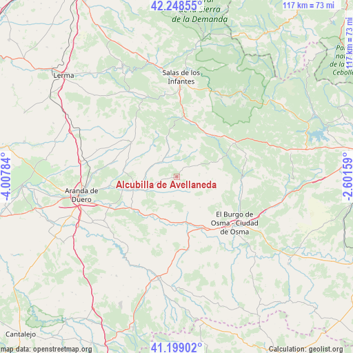
Alcubilla de Avellaneda GPS coordinates[2]
41° 43' 33.348" North, 3° 18' 16.956" West
| Map corner | latitude | longitude |
|---|---|---|
| Upper-left | 42.24855°, | -4.00784° |
| Center: | 41.72593°, | -3.30471° |
| Lower-right: | 41.19902°, | -2.60159° |
| Map W x H: | 116.7×116.7 km | = 72.5×72.5mi |
| max Lat: | 43.74134° ⇑33.3% North |
| Alcubilla de Avellaneda: | 41.72593° |
| min Lat: | ⇓66.7% South 27.64134° |
| min Long | Alcubilla de Av | max Long |
| -18.00367° | -3.30471° | 4.2899° |
| W 50.4%⇐ | ⇒49.6% E |
Elevation
Elevation of Alcubilla de Avellaneda is 930 m = 3051 ft, and this is 332 m = 1089 ft above average elevation for this country.
| Max E: |
1682 m = 5518 ft | 16.8% |
| Alcubilla de Avellaneda | 930 m 3051 ft | |
| Avg. | 598 m = 1962 ft | |
Min E: |
0 m = 0 ft | 83.2% |
See also: Spain elevation on elevation.city.
Geographical zone
Alcubilla de Avellaneda is located in North temperate zone (between Tropic of Cancer and the Arctic Circle). Distance of this Northern Tropic circle is 2033.6 km =1263.6 mi to South.| Distance of | km | miles | from Alcubilla de Avellaneda |
|---|---|---|---|
| North Pole | 5367.6 | 3335.3 | to North |
| Arctic Circle | 2761.7 | 1716 | to North |
| Tropic Cancer | 2033.6 | 1263.6 | to South |
| Equator | 4639.5 | 2882.9 | to South |


Nearby cities:
15 places around Alcubilla de Avellaneda: (largest is in red/bold)
• Arandilla
10.4 km =6.5 mi,  277°
277°
• Arauzo de Miel
16.3 km =10.1 mi,  335°
335°
• Arauzo de Salce
13.7 km =8.5 mi,  319°
319°
• Arauzo de Torre
12.7 km =7.9 mi,  309°
309°
• Brazacorta
5.3 km =3.3 mi,  259°
259°
• Coruña del Conde
8.4 km =5.2 mi,  301°
301°
• Espeja de San Marcelino
10.9 km =6.8 mi,  38°
38°
• Espejón
12.2 km =7.6 mi,  17°
17°
• Fuentearmegil
10.1 km =6.3 mi,  96°
96°
• Hontoria del Pinar
18 km =11.2 mi, 40°
• Huerta del Rey
13.1 km =8.1 mi, 344°
• Langa de Duero
15.2 km =9.4 mi,  211°
211°
• Nafría de Ucero
17.4 km =10.8 mi,  91°
91°
• Peñaranda de Duero
15 km =9.3 mi,  253°
253°
• Santa María de las Hoyas
14.4 km =8.9 mi,  69°
69°
Sources, notices
• [Note1] Compared only with cities in Spain existing in our database
• [Src1] Map data: © OpenStreetMap contributors (CC-BY-SA)
• [Src2] Other city data from geonames.org with taken over terms of usage.
• [Src3] Geographical zone / Annual Mean Temperature by Robert A. Rohde @ Wikipedia
