Huerta del Marquesado geodata
Huerta del Marquesado (Castille-La Mancha) is a seat of a third-order administrative division; located in Spain in Europe/Madrid (GMT+2) time zone. With population of 237 people, there are 4822 cities with bigger population in this country. Compared to other cities in Spain, 68% of cities are located further ↑North; 70.9% of cities are located further ←West and 98.4% of cities have lower elevation than Huerta del Marquesado. Note1
Administrative division(s):
- Level 1: Castille-La Mancha
- Level 2: Provincia de Cuenca
- Level 3: Huerta del Marquesado
Current local time in Huerta del Marquesado:
10:39 PM, ThursdayDifference from your time zone: hours


Huerta del Marquesado GPS coordinates[2]
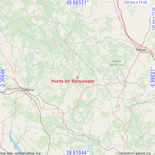
40° 9' 0" North, 1° 40' 59.988" West
| Map corner | latitude | longitude |
|---|---|---|
| Upper-left | 40.68531°, | -2.38646° |
| Center: | 40.15°, | -1.68333° |
| Lower-right: | 39.61044°, | -0.98021° |
| Map W x H: | 119.5×119.5 km | = 74.3×74.3mi |
| max Lat: | 43.74134° ⇑68% North |
| Huerta del Marquesado: | 40.15° |
| min Lat: | ⇓32% South 27.64134° |
| min Long | Huerta del Marq | max Long |
| -18.00367° | -1.68333° | 4.2899° |
| W 70.9%⇐ | ⇒29.1% E |
Elevation
Elevation of Huerta del Marquesado is 1281 m = 4203 ft, and this is 683 m = 2241 ft above average elevation for this country.
| Max E: |
1682 m = 5518 ft | 1.6% |
| Huerta del Marquesado | 1281 m 4203 ft | |
| Avg. | 598 m = 1962 ft | |
Min E: |
0 m = 0 ft | 98.4% |
See also: Spain elevation on elevation.city.
Geographical zone
Huerta del Marquesado is located in North temperate zone (between Tropic of Cancer and the Arctic Circle). Distance of this Northern Tropic circle is 1858.3 km =1154.7 mi to South.| Distance of | km | miles | from Huerta del Marquesado |
|---|---|---|---|
| North Pole | 5542.8 | 3444.1 | to North |
| Arctic Circle | 2936.9 | 1824.9 | to North |
| Tropic Cancer | 1858.3 | 1154.7 | to South |
| Equator | 4464.3 | 2774 | to South |


Nearby cities:
15 places around Huerta del Marquesado: (largest is in red/bold)
• Alcalá de la Vega
19.2 km =11.9 mi,  132°
132°
• Beamud
13 km =8.1 mi,  288°
288°
• Boniches
19.4 km =12.1 mi,  162°
162°
• Campillos-Sierra
5.7 km =3.5 mi,  194°
194°
• Cañete
11.5 km =7.1 mi,  165°
165°
• Huélamo
17.7 km =11 mi,  322°
322°
• Huérguina
14.8 km =9.2 mi,  151°
151°
• Laguna del Marquesado
3.2 km =2 mi,  17°
17°
• Salinas del Manzano
13.5 km =8.4 mi,  123°
123°
• Salvacañete
16.5 km =10.3 mi,  109°
109°
• Tejadillos
4.6 km =2.9 mi, 113°
• Valdemeca
9.7 km =6 mi,  328°
328°
• Valdemorillo de la Sierra
15.5 km =9.6 mi,  213°
213°
• Valdemoro-Sierra
9 km =5.6 mi,  231°
231°
• Zafrilla
7.9 km =4.9 mi,  45°
45°
Sources, notices
• [Note1] Compared only with cities in Spain existing in our database
• [Src1] Map data: © OpenStreetMap contributors (CC-BY-SA)
• [Src2] Other city data from geonames.org with taken over terms of usage.
• [Src3] Geographical zone / Annual Mean Temperature by Robert A. Rohde @ Wikipedia
