Frechilla geodata
Frechilla (Castille and León) is a seat of a third-order administrative division; located in Spain in Europe/Madrid (GMT+2) time zone. With population of 250 people, there are 4740 cities with bigger population in this country. Compared to other cities in Spain, 77.6% of cities are located further ↓South; 70.2% of cities are located further →East and 64.6% of cities have lower elevation than Frechilla. Note1
Administrative division(s):
- Level 1: Castille and León
- Level 2: Provincia de Palencia
- Level 3: Frechilla


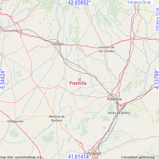
Frechilla GPS coordinates[2]
42° 8' 15.648" North, 4° 50' 28.032" West
| Map corner | latitude | longitude |
|---|---|---|
| Upper-left | 42.65692°, | -5.54424° |
| Center: | 42.13768°, | -4.84112° |
| Lower-right: | 41.61414°, | -4.13799° |
| Map W x H: | 115.9×115.9 km | = 72×72mi |
| max Lat: | 43.74134° ⇑22.4% North |
| Frechilla: | 42.13768° |
| min Lat: | ⇓77.6% South 27.64134° |
| min Long | Frechilla | max Long |
| -18.00367° | -4.84112° | 4.2899° |
| W 29.8%⇐ | ⇒70.2% E |
Elevation
Elevation of Frechilla is 775 m = 2543 ft, and this is 177 m = 581 ft above average elevation for this country.
| Max E: |
1682 m = 5518 ft | 35.4% |
| Frechilla | 775 m 2543 ft | |
| Avg. | 598 m = 1962 ft | |
Min E: |
0 m = 0 ft | 64.6% |
See also: Spain elevation on elevation.city.
Geographical zone
Frechilla is located in North temperate zone (between Tropic of Cancer and the Arctic Circle). Distance of this Northern Tropic circle is 2079.4 km =1292.1 mi to South.| Distance of | km | miles | from Frechilla |
|---|---|---|---|
| North Pole | 5321.8 | 3306.8 | to North |
| Arctic Circle | 2715.9 | 1687.6 | to North |
| Tropic Cancer | 2079.4 | 1292.1 | to South |
| Equator | 4685.3 | 2911.3 | to South |


Nearby cities:
15 places around Frechilla: (largest is in red/bold)
• Autillo de Campos
5.6 km =3.5 mi,  173°
173°
• Baquerín de Campos
14.4 km =8.9 mi,  160°
160°
• Capillas
14.4 km =8.9 mi,  196°
196°
• Castromocho
11.9 km =7.4 mi, 173°
• Cisneros
9.3 km =5.8 mi,  351°
351°
• Fuentes de Nava
7.7 km =4.8 mi,  141°
141°
• Guaza de Campos
5.7 km =3.5 mi,  265°
265°
• Herrín de Campos
9.3 km =5.8 mi,  261°
261°
• Mazuecos de Valdeginate
3.4 km =2.1 mi,  0°
0°
• Paredes de Nava
12.4 km =7.7 mi,  81°
81°
• Pozo de Urama
13.7 km =8.5 mi,  341°
341°
• San Román de la Cuba
13.9 km =8.6 mi, 354°
• Villafrades de Campos
12.6 km =7.8 mi,  238°
238°
• Villanueva del Rebollar
14.1 km =8.8 mi,  35°
35°
• Villarramiel
12 km =7.5 mi,  209°
209°
Sources, notices
• [Note1] Compared only with cities in Spain existing in our database
• [Src1] Map data: © OpenStreetMap contributors (CC-BY-SA)
• [Src2] Other city data from geonames.org with taken over terms of usage.
• [Src3] Geographical zone / Annual Mean Temperature by Robert A. Rohde @ Wikipedia
