Fonfría geodata
Fonfría (Castille and León) is a seat of a third-order administrative division; located in Spain in Europe/Madrid (GMT+2) time zone. With population of 1,029 people, there are 2898 cities with bigger population in this country. Compared to other cities in Spain, 64.4% of cities are located further ↓South; 87.9% of cities are located further →East and 68.9% of cities have lower elevation than Fonfría. Note1
Administrative division(s):
- Level 1: Castille and León
- Level 2: Provincia de Zamora
- Level 3: Fonfría


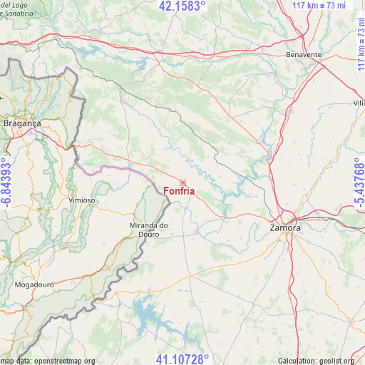
Fonfría GPS coordinates[2]
41° 38' 5.748" North, 6° 8' 26.916" West
| Map corner | latitude | longitude |
|---|---|---|
| Upper-left | 42.1583°, | -6.84393° |
| Center: | 41.63493°, | -6.14081° |
| Lower-right: | 41.10728°, | -5.43768° |
| Map W x H: | 116.9×116.9 km | = 72.6×72.6mi |
| max Lat: | 43.74134° ⇑35.6% North |
| Fonfría: | 41.63493° |
| min Lat: | ⇓64.4% South 27.64134° |
| min Long | Fonfría | max Long |
| -18.00367° | -6.14081° | 4.2899° |
| W 12.1%⇐ | ⇒87.9% E |
Elevation
Elevation of Fonfría is 805 m = 2641 ft, and this is 207 m = 679 ft above average elevation for this country.
| Max E: |
1682 m = 5518 ft | 31.1% |
| Fonfría | 805 m 2641 ft | |
| Avg. | 598 m = 1962 ft | |
Min E: |
0 m = 0 ft | 68.9% |
See also: Spain elevation on elevation.city.
Geographical zone
Fonfría is located in North temperate zone (between Tropic of Cancer and the Arctic Circle). Distance of this Northern Tropic circle is 2023.5 km =1257.3 mi to South.| Distance of | km | miles | from Fonfría |
|---|---|---|---|
| North Pole | 5377.7 | 3341.5 | to North |
| Arctic Circle | 2771.8 | 1722.3 | to North |
| Tropic Cancer | 2023.5 | 1257.3 | to South |
| Equator | 4629.4 | 2876.6 | to South |


Nearby cities:
15 places around Fonfría: (largest is in red/bold)
• Carbajales de Alba
12.1 km =7.5 mi,  80°
80°
• Ferreruela
15.7 km =9.8 mi,  21°
21°
• Gallegos del Río
11.5 km =7.1 mi,  345°
345°
• Losacino
7.2 km =4.5 mi,  44°
44°
• Losacio
11.9 km =7.4 mi, 44°
• Manzanal del Barco
16.1 km =10 mi,  89°
89°
• Moralina
16.1 km =10 mi,  178°
178°
• Rabanales
16.5 km =10.3 mi,  316°
316°
• Samir de los Caños
4.6 km =2.9 mi,  335°
335°
• Torregamones
16.8 km =10.4 mi,  192°
192°
• Vegalatrave
7.8 km =4.8 mi, 21°
• Videmala
8.7 km =5.4 mi,  106°
106°
• Villadepera
9.8 km =6.1 mi, 176°
• Villalcampo
14.7 km =9.1 mi,  148°
148°
• Villardiegua de la Ribera
11.6 km =7.2 mi,  197°
197°
Sources, notices
• [Note1] Compared only with cities in Spain existing in our database
• [Src1] Map data: © OpenStreetMap contributors (CC-BY-SA)
• [Src2] Other city data from geonames.org with taken over terms of usage.
• [Src3] Geographical zone / Annual Mean Temperature by Robert A. Rohde @ Wikipedia
