Ferreruela geodata
Ferreruela (Castille and León) is a seat of a third-order administrative division; located in Spain in Europe/Madrid (GMT+2) time zone. With population of 580 people, there are 3658 cities with bigger population in this country. Compared to other cities in Spain, 67.8% of cities are located further ↓South; 87% of cities are located further →East and 72.1% of cities have lower elevation than Ferreruela. Note1
Administrative division(s):
- Level 1: Castille and León
- Level 2: Provincia de Zamora
- Level 3: Ferreruela


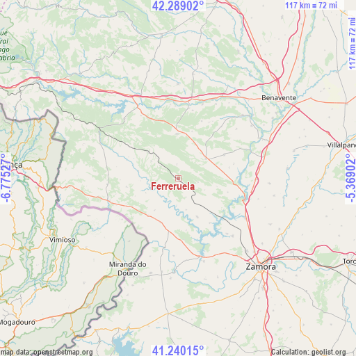
Ferreruela GPS coordinates[2]
41° 46' 0.228" North, 6° 4' 19.74" West
| Map corner | latitude | longitude |
|---|---|---|
| Upper-left | 42.28902°, | -6.77527° |
| Center: | 41.76673°, | -6.07215° |
| Lower-right: | 41.24015°, | -5.36902° |
| Map W x H: | 116.6×116.6 km | = 72.5×72.5mi |
| max Lat: | 43.74134° ⇑32.2% North |
| Ferreruela: | 41.76673° |
| min Lat: | ⇓67.8% South 27.64134° |
| min Long | Ferreruela | max Long |
| -18.00367° | -6.07215° | 4.2899° |
| W 13%⇐ | ⇒87% E |
Elevation
Elevation of Ferreruela is 828 m = 2717 ft, and this is 230 m = 755 ft above average elevation for this country.
| Max E: |
1682 m = 5518 ft | 27.9% |
| Ferreruela | 828 m 2717 ft | |
| Avg. | 598 m = 1962 ft | |
Min E: |
0 m = 0 ft | 72.1% |
See also: Spain elevation on elevation.city.
Geographical zone
Ferreruela is located in North temperate zone (between Tropic of Cancer and the Arctic Circle). Distance of this Northern Tropic circle is 2038.1 km =1266.4 mi to South.| Distance of | km | miles | from Ferreruela |
|---|---|---|---|
| North Pole | 5363 | 3332.4 | to North |
| Arctic Circle | 2757.1 | 1713.2 | to North |
| Tropic Cancer | 2038.1 | 1266.4 | to South |
| Equator | 4644 | 2885.6 | to South |


Nearby cities:
15 places around Ferreruela: (largest is in red/bold)
• Carbajales de Alba
14.1 km =8.8 mi,  153°
153°
• Faramontanos de Tábara
17 km =10.6 mi,  63°
63°
• Ferreras de Abajo
14.4 km =8.9 mi,  357°
357°
• Fonfría
15.7 km =9.8 mi,  201°
201°
• Gallegos del Río
9.2 km =5.7 mi,  247°
247°
• Losacino
9.6 km =6 mi,  183°
183°
• Losacio
6.7 km =4.2 mi,  157°
157°
• Olmillos de Castro
9.5 km =5.9 mi,  114°
114°
• Perilla de Castro
16.9 km =10.5 mi, 105°
• Pozuelo de Tábara
14.9 km =9.3 mi,  82°
82°
• Ríofrío de Aliste
10.4 km =6.5 mi,  302°
302°
• Samir de los Caños
12.9 km =8 mi,  216°
216°
• San Vicente de la Cabeza
15.4 km =9.6 mi,  286°
286°
• Tábara
11 km =6.8 mi,  54°
54°
• Vegalatrave
7.9 km =4.9 mi, 201°
Sources, notices
• [Note1] Compared only with cities in Spain existing in our database
• [Src1] Map data: © OpenStreetMap contributors (CC-BY-SA)
• [Src2] Other city data from geonames.org with taken over terms of usage.
• [Src3] Geographical zone / Annual Mean Temperature by Robert A. Rohde @ Wikipedia
