Castromonte geodata
Castromonte (Castille and León) is a seat of a third-order administrative division; located in Spain in Europe/Madrid (GMT+2) time zone. With population of 389 people, there are 4168 cities with bigger population in this country. Compared to other cities in Spain, 68% of cities are located further ↓South; 73% of cities are located further →East and 74% of cities have lower elevation than Castromonte. Note1
Administrative division(s):
- Level 1: Castille and León
- Level 2: Provincia de Valladolid
- Level 3: Castromonte


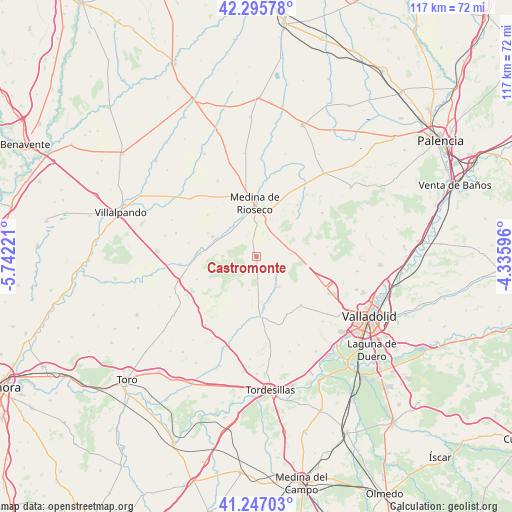
Castromonte GPS coordinates[2]
41° 46' 24.78" North, 5° 2' 20.724" West
| Map corner | latitude | longitude |
|---|---|---|
| Upper-left | 42.29578°, | -5.74221° |
| Center: | 41.77355°, | -5.03909° |
| Lower-right: | 41.24703°, | -4.33596° |
| Map W x H: | 116.6×116.6 km | = 72.5×72.5mi |
| max Lat: | 43.74134° ⇑32% North |
| Castromonte: | 41.77355° |
| min Lat: | ⇓68% South 27.64134° |
| min Long | Castromonte | max Long |
| -18.00367° | -5.03909° | 4.2899° |
| W 27%⇐ | ⇒73% E |
Elevation
Elevation of Castromonte is 843 m = 2766 ft, and this is 245 m = 804 ft above average elevation for this country.
| Max E: |
1682 m = 5518 ft | 26% |
| Castromonte | 843 m 2766 ft | |
| Avg. | 598 m = 1962 ft | |
Min E: |
0 m = 0 ft | 74% |
See also: Spain elevation on elevation.city.
Geographical zone
Castromonte is located in North temperate zone (between Tropic of Cancer and the Arctic Circle). Distance of this Northern Tropic circle is 2038.9 km =1266.9 mi to South.| Distance of | km | miles | from Castromonte |
|---|---|---|---|
| North Pole | 5362.3 | 3332 | to North |
| Arctic Circle | 2756.4 | 1712.7 | to North |
| Tropic Cancer | 2038.9 | 1266.9 | to South |
| Equator | 4644.8 | 2886.1 | to South |


Nearby cities:
15 places around Castromonte: (largest is in red/bold)
• Medina de Ríoseco
12.2 km =7.6 mi,  358°
358°
• Morales de Campos
14.7 km =9.1 mi,  311°
311°
• Peñaflor de Hornija
8.3 km =5.2 mi,  146°
146°
• San Cebrián de Mazote
13.8 km =8.6 mi,  221°
221°
• San Pelayo
10.4 km =6.5 mi,  177°
177°
• Tordehumos
10.9 km =6.8 mi,  295°
295°
• Torrecilla de la Torre
11.9 km =7.4 mi, 184°
• Torrelobatón
13.8 km =8.6 mi, 175°
• Urueña
14.5 km =9 mi,  249°
249°
• Valdenebro de los Valles
10.9 km =6.8 mi,  31°
31°
• Valverde de Campos
6.8 km =4.2 mi,  1°
1°
• Villabrágima
8.3 km =5.2 mi, 310°
• Villagarcía de Campos
12.7 km =7.9 mi,  273°
273°
• Villasexmir
15.1 km =9.4 mi,  188°
188°
• Wamba
14.9 km =9.3 mi,  137°
137°
Sources, notices
• [Note1] Compared only with cities in Spain existing in our database
• [Src1] Map data: © OpenStreetMap contributors (CC-BY-SA)
• [Src2] Other city data from geonames.org with taken over terms of usage.
• [Src3] Geographical zone / Annual Mean Temperature by Robert A. Rohde @ Wikipedia
