Cañas geodata
Cañas (La Rioja) is a seat of a third-order administrative division; located in Spain in Europe/Madrid (GMT+2) time zone. With population of 142 people, there are 5486 cities with bigger population in this country. Compared to other cities in Spain, 84.6% of cities are located further ↓South; 56.8% of cities are located further ←West and 51.7% of cities have higher elevation than Cañas. Note1


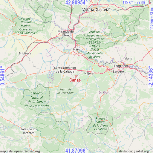
Cañas GPS coordinates[2]
42° 23' 32.64" North, 2° 50' 47.364" West
| Map corner | latitude | longitude |
|---|---|---|
| Upper-left | 42.90954°, | -3.54961° |
| Center: | 42.3924°, | -2.84649° |
| Lower-right: | 41.87096°, | -2.14336° |
| Map W x H: | 115.5×115.5 km | = 71.8×71.8mi |
| max Lat: | 43.74134° ⇑15.4% North |
| Cañas: | 42.3924° |
| min Lat: | ⇓84.6% South 27.64134° |
| min Long | Cañas | max Long |
| -18.00367° | -2.84649° | 4.2899° |
| W 56.8%⇐ | ⇒43.2% E |
Elevation
Elevation of Cañas is 641 m = 2103 ft, and this is 43 m = 141 ft above average elevation for this country.
| Max E: |
1682 m = 5518 ft | 51.7% |
| Cañas | 641 m 2103 ft | |
| Avg. | 598 m = 1962 ft | |
Min E: |
0 m = 0 ft | 48.3% |
See also: Spain elevation on elevation.city.
Geographical zone
Cañas is located in North temperate zone (between Tropic of Cancer and the Arctic Circle). Distance of this Northern Tropic circle is 2107.7 km =1309.7 mi to South.| Distance of | km | miles | from Cañas |
|---|---|---|---|
| North Pole | 5293.5 | 3289.2 | to North |
| Arctic Circle | 2687.6 | 1670 | to North |
| Tropic Cancer | 2107.7 | 1309.7 | to South |
| Equator | 4713.6 | 2928.9 | to South |


Nearby cities:
15 places around Cañas: (largest is in red/bold)
• Alesanco
3.4 km =2.1 mi,  45°
45°
• Azofra
5.1 km =3.2 mi, 46°
• Badarán
4 km =2.5 mi,  132°
132°
• Berceo
6 km =3.7 mi,  184°
184°
• Canillas de Río Tuerto
0.9 km =0.6 mi,  30°
30°
• Cirueña
4.6 km =2.9 mi,  298°
298°
• Cordovín
2.7 km =1.7 mi,  106°
106°
• Cárdenas
6.8 km =4.2 mi, 106°
• Estollo
7 km =4.3 mi, 182°
• Hervías
7 km =4.3 mi,  331°
331°
• Manzanares de Rioja
4.1 km =2.5 mi,  275°
275°
• San Millán de la Cogolla
7.1 km =4.4 mi,  190°
190°
• Torrecilla sobre Alesanco
2 km =1.2 mi, 30°
• Villar de Torre
2.8 km =1.7 mi,  211°
211°
• Villarejo
3.9 km =2.4 mi,  238°
238°
Sources, notices
• [Note1] Compared only with cities in Spain existing in our database
• [Src1] Map data: © OpenStreetMap contributors (CC-BY-SA)
• [Src2] Other city data from geonames.org with taken over terms of usage.
• [Src3] Geographical zone / Annual Mean Temperature by Robert A. Rohde @ Wikipedia
