Avellaneda geodata
Avellaneda (Castille and León) is a seat of a third-order administrative division; located in Spain in Europe/Madrid (GMT+2) time zone. With population of 41 people, there are 6557 cities with bigger population in this country. Compared to other cities in Spain, 64.2% of cities are located further ↑North; 77.3% of cities are located further →East and 99% of cities have lower elevation than Avellaneda. Note1
Administrative division(s):
- Level 1: Castille and León
- Level 2: Provincia de Ávila
- Level 3: Avellaneda


Avellaneda GPS coordinates[2]
40° 23' 20.724" North, 5° 23' 17.196" West
| Map corner | latitude | longitude |
|---|---|---|
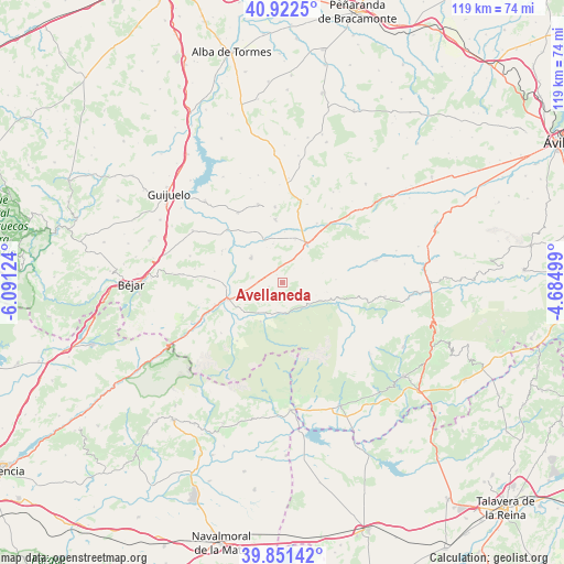
| Upper-left | 40.9225°, | -6.09124° |
| Center: | 40.38909°, | -5.38811° |
| Lower-right: | 39.85142°, | -4.68499° |
| Map W x H: | 119.1×119.1 km | = 74×74mi |
| max Lat: | 43.74134° ⇑64.2% North |
| Avellaneda: | 40.38909° |
| min Lat: | ⇓35.8% South 27.64134° |
| min Long | Avellaneda | max Long |
| -18.00367° | -5.38811° | 4.2899° |
| W 22.7%⇐ | ⇒77.3% E |
Elevation
Elevation of Avellaneda is 1353 m = 4439 ft, and this is 755 m = 2477 ft above average elevation for this country.
| Max E: |
1682 m = 5518 ft | 1% |
| Avellaneda | 1353 m 4439 ft | |
| Avg. | 598 m = 1962 ft | |
Min E: |
0 m = 0 ft | 99% |
See also: Spain elevation on elevation.city.
Geographical zone
Avellaneda is located in North temperate zone (between Tropic of Cancer and the Arctic Circle). Distance of this Northern Tropic circle is 1884.9 km =1171.2 mi to South.| Distance of | km | miles | from Avellaneda |
|---|---|---|---|
| North Pole | 5516.2 | 3427.6 | to North |
| Arctic Circle | 2910.3 | 1808.4 | to North |
| Tropic Cancer | 1884.9 | 1171.2 | to South |
| Equator | 4490.8 | 2790.5 | to South |


Nearby cities:
15 places around Avellaneda: (largest is in red/bold)
• Aldeanueva de Santa Cruz
2.9 km =1.8 mi,  254°
254°
• Bohoyo
9.4 km =5.8 mi,  209°
209°
• El Barco de Ávila
12 km =7.5 mi, 252°
• Hoyorredondo
8.4 km =5.2 mi,  346°
346°
• La Horcajada
8.5 km =5.3 mi,  308°
308°
• Navaescurial
13.1 km =8.1 mi,  45°
45°
• Navalperal de Tormes
8.4 km =5.2 mi,  118°
118°
• Navamorales
12.4 km =7.7 mi,  321°
321°
• San Bartolomé de Corneja
11.5 km =7.1 mi,  1°
1°
• San Lorenzo de Tormes
8.8 km =5.5 mi,  255°
255°
• Santa María de los Caballeros
5.3 km =3.3 mi,  270°
270°
• Santa María del Berrocal
13.3 km =8.3 mi, 353°
• Santiago del Collado
5.6 km =3.5 mi,  28°
28°
• Villar de Corneja
10.2 km =6.3 mi,  338°
338°
• Zapardiel de la Ribera
6.3 km =3.9 mi,  126°
126°
Sources, notices
• [Note1] Compared only with cities in Spain existing in our database
• [Src1] Map data: © OpenStreetMap contributors (CC-BY-SA)
• [Src2] Other city data from geonames.org with taken over terms of usage.
• [Src3] Geographical zone / Annual Mean Temperature by Robert A. Rohde @ Wikipedia
