Argañín geodata
Argañín (Castille and León) is a seat of a third-order administrative division; located in Spain in Europe/Madrid (GMT+2) time zone. With population of 86 people, there are 6079 cities with bigger population in this country. Compared to other cities in Spain, 59.2% of cities are located further ↓South; 88.6% of cities are located further →East and 59.2% of cities have lower elevation than Argañín. Note1
Administrative division(s):
- Level 1: Castille and León
- Level 2: Provincia de Zamora
- Level 3: Argañín


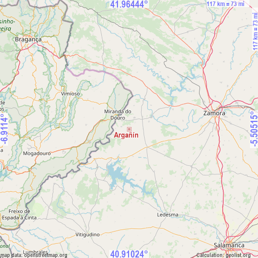
Argañín GPS coordinates[2]
41° 26' 22.128" North, 6° 12' 29.772" West
| Map corner | latitude | longitude |
|---|---|---|
| Upper-left | 41.96444°, | -6.9114° |
| Center: | 41.43948°, | -6.20827° |
| Lower-right: | 40.91024°, | -5.50515° |
| Map W x H: | 117.2×117.2 km | = 72.8×72.8mi |
| max Lat: | 43.74134° ⇑40.8% North |
| Argañín: | 41.43948° |
| min Lat: | ⇓59.2% South 27.64134° |
| min Long | Argañín | max Long |
| -18.00367° | -6.20827° | 4.2899° |
| W 11.4%⇐ | ⇒88.6% E |
Elevation
Elevation of Argañín is 739 m = 2425 ft, and this is 141 m = 463 ft above average elevation for this country.
| Max E: |
1682 m = 5518 ft | 40.8% |
| Argañín | 739 m 2425 ft | |
| Avg. | 598 m = 1962 ft | |
Min E: |
0 m = 0 ft | 59.2% |
See also: Spain elevation on elevation.city.
Geographical zone
Argañín is located in North temperate zone (between Tropic of Cancer and the Arctic Circle). Distance of this Northern Tropic circle is 2001.7 km =1243.8 mi to South.| Distance of | km | miles | from Argañín |
|---|---|---|---|
| North Pole | 5399.4 | 3355 | to North |
| Arctic Circle | 2793.5 | 1735.8 | to North |
| Tropic Cancer | 2001.7 | 1243.8 | to South |
| Equator | 4607.6 | 2863 | to South |


Nearby cities:
15 places around Argañín: (largest is in red/bold)
• Bermillo de Sayago
11.4 km =7.1 mi,  135°
135°
• Fariza
5.5 km =3.4 mi,  242°
242°
• Fermoselle
20.7 km =12.9 mi,  229°
229°
• Gamones
4.1 km =2.5 mi,  41°
41°
• Luelmo
6.2 km =3.9 mi,  89°
89°
• Moral de Sayago
9.6 km =6 mi,  69°
69°
• Moralina
8.2 km =5.1 mi,  46°
46°
• Muelas del Pan
21.8 km =13.5 mi, 65°
• Muga de Sayago
5.8 km =3.6 mi,  171°
171°
• Salce
18.9 km =11.7 mi,  182°
182°
• Torregamones
5.7 km =3.5 mi,  21°
21°
• Villadepera
13.5 km =8.4 mi,  27°
27°
• Villalcampo
16.2 km =10.1 mi,  55°
55°
• Villar del Buey
12.2 km =7.6 mi, 172°
• Villardiegua de la Ribera
10.9 km =6.8 mi,  11°
11°
Sources, notices
• [Note1] Compared only with cities in Spain existing in our database
• [Src1] Map data: © OpenStreetMap contributors (CC-BY-SA)
• [Src2] Other city data from geonames.org with taken over terms of usage.
• [Src3] Geographical zone / Annual Mean Temperature by Robert A. Rohde @ Wikipedia
