Fermoselle geodata
Fermoselle (Castille and León) is a seat of a third-order administrative division; located in Spain in Europe/Madrid (GMT+2) time zone. With population of 1,538 people, there are 2435 cities with bigger population in this country. Compared to other cities in Spain, 55.6% of cities are located further ↓South; 90.3% of cities are located further →East and 54.1% of cities have lower elevation than Fermoselle. Note1
Administrative division(s):
- Level 1: Castille and León
- Level 2: Provincia de Zamora
- Level 3: Fermoselle


Fermoselle GPS coordinates[2]
41° 19' 2.568" North, 6° 23' 45.024" West
| Map corner | latitude | longitude |
|---|---|---|
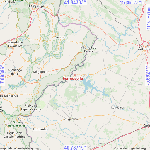
| Upper-left | 41.84333°, | -7.09896° |
| Center: | 41.31738°, | -6.39584° |
| Lower-right: | 40.78715°, | -5.69271° |
| Map W x H: | 117.4×117.4 km | = 72.9×72.9mi |
| max Lat: | 43.74134° ⇑44.4% North |
| Fermoselle: | 41.31738° |
| min Lat: | ⇓55.6% South 27.64134° |
| min Long | Fermoselle | max Long |
| -18.00367° | -6.39584° | 4.2899° |
| W 9.7%⇐ | ⇒90.3% E |
Elevation
Elevation of Fermoselle is 701 m = 2300 ft, and this is 103 m = 338 ft above average elevation for this country.
| Max E: |
1682 m = 5518 ft | 45.9% |
| Fermoselle | 701 m 2300 ft | |
| Avg. | 598 m = 1962 ft | |
Min E: |
0 m = 0 ft | 54.1% |
See also: Spain elevation on elevation.city.
Geographical zone
Fermoselle is located in North temperate zone (between Tropic of Cancer and the Arctic Circle). Distance of this Northern Tropic circle is 1988.1 km =1235.3 mi to South.| Distance of | km | miles | from Fermoselle |
|---|---|---|---|
| North Pole | 5413 | 3363.5 | to North |
| Arctic Circle | 2807.1 | 1744.3 | to North |
| Tropic Cancer | 1988.1 | 1235.3 | to South |
| Equator | 4594.1 | 2854.6 | to South |


Nearby cities:
15 places around Fermoselle: (largest is in red/bold)
• Ahigal de Villarino
17.7 km =11 mi,  175°
175°
• Aldeadávila de la Ribera
21.6 km =13.4 mi,  239°
239°
• Almendra
10.8 km =6.7 mi,  154°
154°
• Argañín
20.7 km =12.9 mi,  49°
49°
• Fariza
15.4 km =9.6 mi,  44°
44°
• Iruelos
20.4 km =12.7 mi,  163°
163°
• Masueco
20.5 km =12.7 mi,  231°
231°
• Monleras
20.3 km =12.6 mi,  135°
135°
• Muga de Sayago
18.3 km =11.4 mi,  64°
64°
• Salce
15.7 km =9.8 mi,  109°
109°
• Sardón de los Frailes
15.5 km =9.6 mi, 137°
• Trabanca
9.5 km =5.9 mi,  174°
174°
• Villar de Samaniego
22.5 km =14 mi,  187°
187°
• Villar del Buey
17.3 km =10.7 mi,  85°
85°
• Villarino de los Aires
8 km =5 mi, 229°
Sources, notices
• [Note1] Compared only with cities in Spain existing in our database
• [Src1] Map data: © OpenStreetMap contributors (CC-BY-SA)
• [Src2] Other city data from geonames.org with taken over terms of usage.
• [Src3] Geographical zone / Annual Mean Temperature by Robert A. Rohde @ Wikipedia
