Villar del Buey geodata
Villar del Buey (Castille and León) is a seat of a third-order administrative division; located in Spain in Europe/Madrid (GMT+2) time zone. With population of 790 people, there are 3231 cities with bigger population in this country. Compared to other cities in Spain, 55.8% of cities are located further ↓South; 88.4% of cities are located further →East and 64.1% of cities have lower elevation than Villar del Buey. Note1
Administrative division(s):
- Level 1: Castille and León
- Level 2: Provincia de Zamora
- Level 3: Villar del Buey


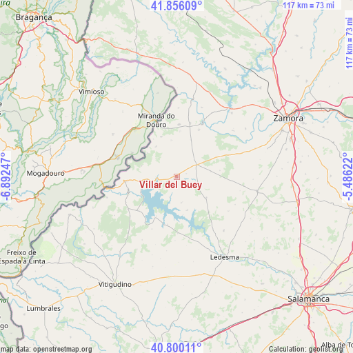
Villar del Buey GPS coordinates[2]
41° 19' 48.864" North, 6° 11' 21.66" West
| Map corner | latitude | longitude |
|---|---|---|
| Upper-left | 41.85609°, | -6.89247° |
| Center: | 41.33024°, | -6.18935° |
| Lower-right: | 40.80011°, | -5.48622° |
| Map W x H: | 117.4×117.4 km | = 72.9×72.9mi |
| max Lat: | 43.74134° ⇑44.2% North |
| Villar del Buey: | 41.33024° |
| min Lat: | ⇓55.8% South 27.64134° |
| min Long | Villar del Buey | max Long |
| -18.00367° | -6.18935° | 4.2899° |
| W 11.6%⇐ | ⇒88.4% E |
Elevation
Elevation of Villar del Buey is 772 m = 2533 ft, and this is 174 m = 571 ft above average elevation for this country.
| Max E: |
1682 m = 5518 ft | 35.9% |
| Villar del Buey | 772 m 2533 ft | |
| Avg. | 598 m = 1962 ft | |
Min E: |
0 m = 0 ft | 64.1% |
See also: Spain elevation on elevation.city.
Geographical zone
Villar del Buey is located in North temperate zone (between Tropic of Cancer and the Arctic Circle). Distance of this Northern Tropic circle is 1989.6 km =1236.3 mi to South.| Distance of | km | miles | from Villar del Buey |
|---|---|---|---|
| North Pole | 5411.6 | 3362.6 | to North |
| Arctic Circle | 2805.7 | 1743.4 | to North |
| Tropic Cancer | 1989.6 | 1236.3 | to South |
| Equator | 4595.5 | 2855.5 | to South |


Nearby cities:
15 places around Villar del Buey: (largest is in red/bold)
• Almeida
12 km =7.5 mi,  126°
126°
• Almendra
16.9 km =10.5 mi,  228°
228°
• Argañín
12.2 km =7.6 mi,  352°
352°
• Bermillo de Sayago
7.6 km =4.7 mi,  57°
57°
• Carbellino
11.7 km =7.3 mi,  163°
163°
• Fariza
11.6 km =7.2 mi,  326°
326°
• Fermoselle
17.3 km =10.7 mi,  265°
265°
• Gamones
15.2 km =9.4 mi,  4°
4°
• Luelmo
13.1 km =8.1 mi,  20°
20°
• Monleras
16.2 km =10.1 mi,  190°
190°
• Moral de Sayago
17.2 km =10.7 mi,  25°
25°
• Muga de Sayago
6.4 km =4 mi, 353°
• Salce
7.1 km =4.4 mi,  200°
200°
• Sardón de los Frailes
14.6 km =9.1 mi,  207°
207°
• Torregamones
17.4 km =10.8 mi, 1°
Sources, notices
• [Note1] Compared only with cities in Spain existing in our database
• [Src1] Map data: © OpenStreetMap contributors (CC-BY-SA)
• [Src2] Other city data from geonames.org with taken over terms of usage.
• [Src3] Geographical zone / Annual Mean Temperature by Robert A. Rohde @ Wikipedia
