Abánades geodata
Abánades (Castille-La Mancha) is a seat of a third-order administrative division; located in Spain in Europe/Madrid (GMT+2) time zone. With population of 106 people, there are 5853 cities with bigger population in this country. Compared to other cities in Spain, 54% of cities are located further ↑North; 61.1% of cities are located further ←West and 89.9% of cities have lower elevation than Abánades. Note1
Administrative division(s):
- Level 1: Castille-La Mancha
- Level 2: Provincia de Guadalajara
- Level 3: Abánades


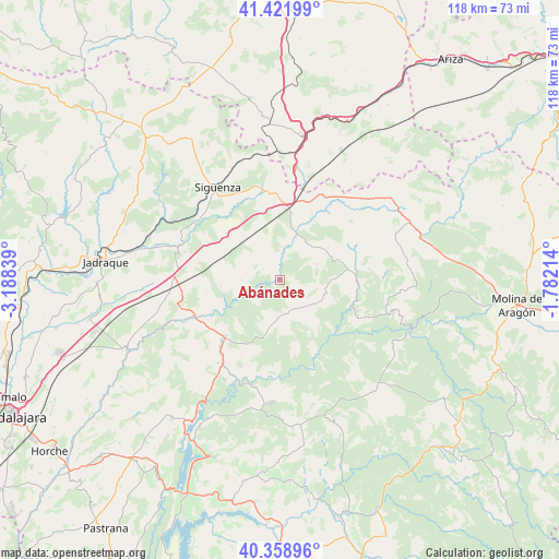
Abánades GPS coordinates[2]
40° 53' 33.396" North, 2° 29' 6.936" West
| Map corner | latitude | longitude |
|---|---|---|
| Upper-left | 41.42199°, | -3.18839° |
| Center: | 40.89261°, | -2.48526° |
| Lower-right: | 40.35896°, | -1.78214° |
| Map W x H: | 118.2×118.2 km | = 73.4×73.4mi |
| max Lat: | 43.74134° ⇑54% North |
| Abánades: | 40.89261° |
| min Lat: | ⇓46% South 27.64134° |
| min Long | Abánades | max Long |
| -18.00367° | -2.48526° | 4.2899° |
| W 61.1%⇐ | ⇒38.9% E |
Elevation
Elevation of Abánades is 1029 m = 3376 ft, and this is 431 m = 1414 ft above average elevation for this country.
| Max E: |
1682 m = 5518 ft | 10.1% |
| Abánades | 1029 m 3376 ft | |
| Avg. | 598 m = 1962 ft | |
Min E: |
0 m = 0 ft | 89.9% |
See also: Spain elevation on elevation.city.
Geographical zone
Abánades is located in North temperate zone (between Tropic of Cancer and the Arctic Circle). Distance of this Northern Tropic circle is 1940.9 km =1206 mi to South.| Distance of | km | miles | from Abánades |
|---|---|---|---|
| North Pole | 5460.2 | 3392.8 | to North |
| Arctic Circle | 2854.3 | 1773.6 | to North |
| Tropic Cancer | 1940.9 | 1206 | to South |
| Equator | 4546.8 | 2825.2 | to South |


Nearby cities:
15 places around Abánades: (largest is in red/bold)
• Alcolea del Pinar
16 km =9.9 mi,  5°
5°
• Algora
17.2 km =10.7 mi,  297°
297°
• Canredondo
8.9 km =5.5 mi,  184°
184°
• Cifuentes
16.5 km =10.3 mi,  224°
224°
• Esplegares
10.4 km =6.5 mi,  112°
112°
• Iniéstola
14.8 km =9.2 mi,  40°
40°
• Luzaga
9.6 km =6 mi,  20°
20°
• Ocentejo
15.3 km =9.5 mi,  151°
151°
• Riba de Saelices
15.9 km =9.9 mi,  82°
82°
• Sacecorbo
8.7 km =5.4 mi,  139°
139°
• Saelices de la Sal
13.7 km =8.5 mi, 83°
• Saúca
15.8 km =9.8 mi,  346°
346°
• Sotodosos
8.5 km =5.3 mi,  67°
67°
• Torrecuadradilla
5.9 km =3.7 mi, 222°
• Torremocha del Campo
14.7 km =9.1 mi,  310°
310°
Sources, notices
• [Note1] Compared only with cities in Spain existing in our database
• [Src1] Map data: © OpenStreetMap contributors (CC-BY-SA)
• [Src2] Other city data from geonames.org with taken over terms of usage.
• [Src3] Geographical zone / Annual Mean Temperature by Robert A. Rohde @ Wikipedia
