Riba de Saelices geodata
Riba de Saelices (Castille-La Mancha) is a seat of a third-order administrative division; located in Spain in Europe/Madrid (GMT+2) time zone. With population of 177 people, there are 5203 cities with bigger population in this country. Compared to other cities in Spain, 53.6% of cities are located further ↑North; 63.5% of cities are located further ←West and 87.1% of cities have lower elevation than Riba de Saelices. Note1
Administrative division(s):
- Level 1: Castille-La Mancha
- Level 2: Provincia de Guadalajara
- Level 3: Riba de Saelices


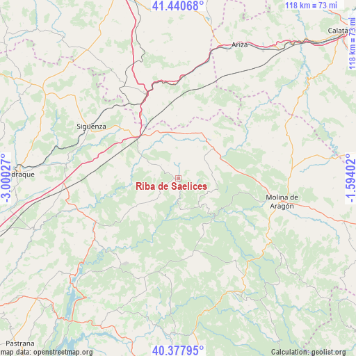
Riba de Saelices GPS coordinates[2]
40° 54' 41.22" North, 2° 17' 49.74" West
| Map corner | latitude | longitude |
|---|---|---|
| Upper-left | 41.44068°, | -3.00027° |
| Center: | 40.91145°, | -2.29715° |
| Lower-right: | 40.37795°, | -1.59402° |
| Map W x H: | 118.2×118.2 km | = 73.4×73.4mi |
| max Lat: | 43.74134° ⇑53.6% North |
| Riba de Saelices: | 40.91145° |
| min Lat: | ⇓46.4% South 27.64134° |
| min Long | Riba de Saelice | max Long |
| -18.00367° | -2.29715° | 4.2899° |
| W 63.5%⇐ | ⇒36.5% E |
Elevation
Elevation of Riba de Saelices is 984 m = 3228 ft, and this is 386 m = 1266 ft above average elevation for this country.
| Max E: |
1682 m = 5518 ft | 12.9% |
| Riba de Saelices | 984 m 3228 ft | |
| Avg. | 598 m = 1962 ft | |
Min E: |
0 m = 0 ft | 87.1% |
See also: Spain elevation on elevation.city.
Geographical zone
Riba de Saelices is located in North temperate zone (between Tropic of Cancer and the Arctic Circle). Distance of this Northern Tropic circle is 1943 km =1207.3 mi to South.| Distance of | km | miles | from Riba de Saelices |
|---|---|---|---|
| North Pole | 5458.1 | 3391.5 | to North |
| Arctic Circle | 2852.2 | 1772.3 | to North |
| Tropic Cancer | 1943 | 1207.3 | to South |
| Equator | 4548.9 | 2826.6 | to South |


Nearby cities:
15 places around Riba de Saelices: (largest is in red/bold)
• Ablanque
6.2 km =3.9 mi,  103°
103°
• Abánades
15.9 km =9.9 mi,  262°
262°
• Anguita
14.1 km =8.8 mi,  334°
334°
• Anquela del Ducado
15.5 km =9.6 mi,  64°
64°
• Cobeta
14 km =8.7 mi,  111°
111°
• Esplegares
8.7 km =5.4 mi,  225°
225°
• Huertahernando
9.8 km =6.1 mi,  174°
174°
• Iniéstola
11.1 km =6.9 mi, 326°
• Luzaga
14.2 km =8.8 mi,  299°
299°
• Luzón
12.9 km =8 mi,  7°
7°
• Mazarete
15.3 km =9.5 mi,  49°
49°
• Olmeda de Cobeta
11.2 km =7 mi,  120°
120°
• Sacecorbo
13.4 km =8.3 mi, 229°
• Saelices de la Sal
2.2 km =1.4 mi, 257°
• Sotodosos
8.1 km =5 mi,  277°
277°
Sources, notices
• [Note1] Compared only with cities in Spain existing in our database
• [Src1] Map data: © OpenStreetMap contributors (CC-BY-SA)
• [Src2] Other city data from geonames.org with taken over terms of usage.
• [Src3] Geographical zone / Annual Mean Temperature by Robert A. Rohde @ Wikipedia
