Velkua geodata
Velkua (Southwest Finland) is a seat of a third-order administrative division; located in Finland in Europe/Helsinki (GMT+3) time zone. With population of 217 people, there are 442 cities with bigger population in this country. Compared to other cities in Finland, 87% of cities are located further ↑North; 96.2% of cities are located further →East and 100% of cities have higher elevation than Velkua. Note1


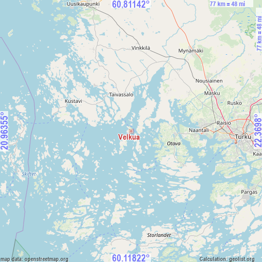
Velkua GPS coordinates[2]
60° 28' 0.012" North, 21° 40' 0.012" East
| Map corner | latitude | longitude |
|---|---|---|
| Upper-left | 60.81142°, | 20.96355° |
| Center: | 60.46667°, | 21.66667° |
| Lower-right: | 60.11822°, | 22.3698° |
| Map W x H: | 77.1×77.1 km | = 47.9×47.9mi |
| max Lat: | 69.90864° ⇑87% North |
| Velkua: | 60.46667° |
| min Lat: | ⇓13% South 59.83333° |
| min Long | Velkua | max Long |
| 21.2° | 21.66667° | 30.93276° |
| W 3.8%⇐ | ⇒96.2% E |
Elevation
Elevation of Velkua is 1 m = 3 ft, and this is 76.1 m = 250 ft below average elevation for this country.
| Max E: |
299 m = 981 ft | 100% |
| Avg. | 77.1 m = 253 ft | |
| Velkua | 1 m = 3 ft | |
Min E: |
1 m = 3 ft | 0% |
See also: Finland elevation on elevation.city.
Geographical zone
Velkua is located in North temperate zone (between Tropic of Cancer and the Arctic Circle). Distance of this North polar circle is 677.9 km =421.2 mi to North.| Distance of | km | miles | from Velkua |
|---|---|---|---|
| North Pole | 3283.8 | 2040.5 | to North |
| Arctic Circle | 677.9 | 421.2 | to North |
| Tropic Cancer | 4117.3 | 2558.4 | to South |
| Equator | 6723.3 | 4177.7 | to South |


Nearby cities:
15 places around Velkua: (largest is in red/bold)
• Askainen
15.6 km =9.7 mi,  44°
44°
• Iniö
16.4 km =10.2 mi,  243°
243°
• Kustavi
19 km =11.8 mi,  297°
297°
• Lemu
19.8 km =12.3 mi,  55°
55°
• Masku
26.3 km =16.3 mi, 63°
• Merimasku
11.1 km =6.9 mi,  80°
80°
• Mietoinen
23.6 km =14.7 mi, 38°
• Mynämäki
29.6 km =18.4 mi, 37°
• Naantali
19.6 km =12.2 mi,  89°
89°
• Nousiainen
27.3 km =17 mi, 55°
• Raisio
27.6 km =17.1 mi, 85°
• Rymättylä
18.1 km =11.2 mi,  123°
123°
• Taivassalo
10.8 km =6.7 mi,  345°
345°
• Vehmaa
24.1 km =15 mi,  0°
0°
• Vinkkilä
24.2 km =15 mi,  6°
6°
Sources, notices
• [Note1] Compared only with cities in Finland existing in our database
• [Src1] Map data: © OpenStreetMap contributors (CC-BY-SA)
• [Src2] Other city data from geonames.org with taken over terms of usage.
• [Src3] Geographical zone / Annual Mean Temperature by Robert A. Rohde @ Wikipedia
