Vantaa geodata
Vantaa (Uusimaa) is a seat of a third-order administrative division; located in Finland in Europe/Helsinki (GMT+3) time zone. With population of 190,058 people, there are 3 cities with bigger population in this country. Compared to other cities in Finland, 92.9% of cities are located further ↑North; 56% of cities are located further ←West and 81.4% of cities have higher elevation than Vantaa. Note1


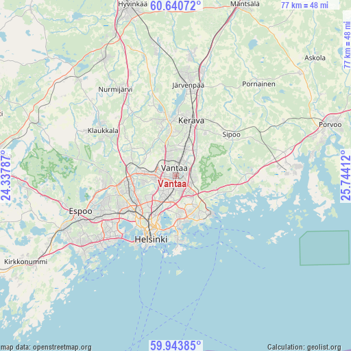
Vantaa GPS coordinates[2]
60° 17' 38.904" North, 25° 2' 27.564" East
| Map corner | latitude | longitude |
|---|---|---|
| Upper-left | 60.64072°, | 24.33787° |
| Center: | 60.29414°, | 25.04099° |
| Lower-right: | 59.94385°, | 25.74412° |
| Map W x H: | 77.5×77.5 km | = 48.2×48.2mi |
| max Lat: | 69.90864° ⇑92.9% North |
| Vantaa: | 60.29414° |
| min Lat: | ⇓7.1% South 59.83333° |
| min Long | Vantaa | max Long |
| 21.2° | 25.04099° | 30.93276° |
| W 56%⇐ | ⇒44% E |
Elevation
Elevation of Vantaa is 18 m = 59 ft, and this is 59.1 m = 194 ft below average elevation for this country.
| Max E: |
299 m = 981 ft | 81.4% |
| Avg. | 77.1 m = 253 ft | |
| Vantaa | 18 m = 59 ft | |
Min E: |
1 m = 3 ft | 18.6% |
See also: Vantaa elevation on elevation.city.
Geographical zone
Vantaa is located in North temperate zone (between Tropic of Cancer and the Arctic Circle). Distance of this North polar circle is 697.1 km =433.2 mi to North.| Distance of | km | miles | from Vantaa |
|---|---|---|---|
| North Pole | 3303 | 2052.4 | to North |
| Arctic Circle | 697.1 | 433.2 | to North |
| Tropic Cancer | 4098.2 | 2546.5 | to South |
| Equator | 6704.1 | 4165.7 | to South |


Nearby cities:
15 places around Vantaa: (largest is in red/bold)
• Helsinki
15 km =9.3 mi,  202°
202°
• Kaarela
10 km =6.2 mi,  241°
241°
• Kallio
13.2 km =8.2 mi, 202°
• Kerava
12.6 km =7.8 mi,  16°
16°
• Kilo
16.7 km =10.4 mi, 239°
• Lauttasaari
17.8 km =11.1 mi,  212°
212°
• Mellunkylä
7.5 km =4.7 mi,  154°
154°
• Munkkiniemi
13.9 km =8.6 mi,  220°
220°
• Nickby
16.6 km =10.3 mi,  53°
53°
• Otaniemi
17 km =10.6 mi, 223°
• Sibbo
15.6 km =9.7 mi, 53°
• Suomenlinna
16.6 km =10.3 mi,  190°
190°
• Tuusula
12.2 km =7.6 mi,  356°
356°
• Vuosaari
10.9 km =6.8 mi, 149°
• Östersundom
9.3 km =5.8 mi,  115°
115°
Sources, notices
• [Note1] Compared only with cities in Finland existing in our database
• [Src1] Map data: © OpenStreetMap contributors (CC-BY-SA)
• [Src2] Other city data from geonames.org with taken over terms of usage.
• [Src3] Geographical zone / Annual Mean Temperature by Robert A. Rohde @ Wikipedia
