Suomusjärvi geodata
Suomusjärvi (Southwest Finland) is a seat of a third-order administrative division; located in Finland in Europe/Helsinki (GMT+3) time zone. With population of 1,310 people, there are 408 cities with bigger population in this country. Compared to other cities in Finland, 91.9% of cities are located further ↑North; 66.9% of cities are located further →East and 69.7% of cities have lower elevation than Suomusjärvi. Note1


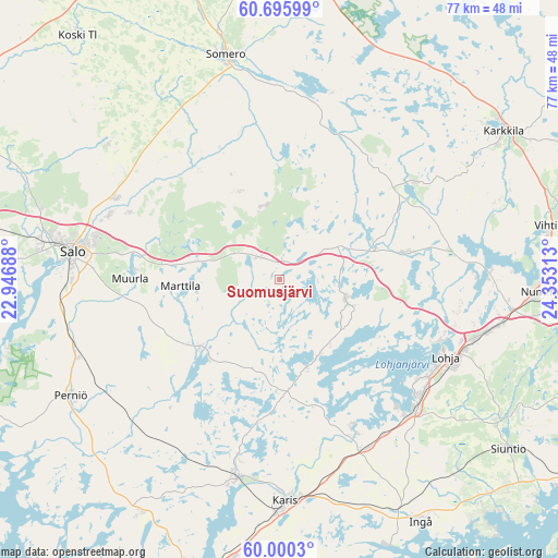
Suomusjärvi GPS coordinates[2]
60° 21' 0" North, 23° 39' 0" East
| Map corner | latitude | longitude |
|---|---|---|
| Upper-left | 60.69599°, | 22.94688° |
| Center: | 60.35°, | 23.65° |
| Lower-right: | 60.0003°, | 24.35313° |
| Map W x H: | 77.4×77.4 km | = 48.1×48.1mi |
| max Lat: | 69.90864° ⇑91.9% North |
| Suomusjärvi: | 60.35° |
| min Lat: | ⇓8.1% South 59.83333° |
| min Long | Suomusjärvi | max Long |
| 21.2° | 23.65° | 30.93276° |
| W 33.1%⇐ | ⇒66.9% E |
Elevation
Elevation of Suomusjärvi is 105 m = 344 ft, and this is 27.9 m = 92 ft above average elevation for this country.
| Max E: |
299 m = 981 ft | 30.3% |
| Suomusjärvi | 105 m 344 ft | |
| Avg. | 77.1 m = 253 ft | |
Min E: |
1 m = 3 ft | 69.7% |
See also: Finland elevation on elevation.city.
Geographical zone
Suomusjärvi is located in North temperate zone (between Tropic of Cancer and the Arctic Circle). Distance of this North polar circle is 690.9 km =429.3 mi to North.| Distance of | km | miles | from Suomusjärvi |
|---|---|---|---|
| North Pole | 3296.8 | 2048.5 | to North |
| Arctic Circle | 690.9 | 429.3 | to North |
| Tropic Cancer | 4104.4 | 2550.4 | to South |
| Equator | 6710.3 | 4169.6 | to South |


Nearby cities:
15 places around Suomusjärvi: (largest is in red/bold)
• Halikko
31.6 km =19.6 mi,  280°
280°
• Karis
30.9 km =19.2 mi,  178°
178°
• Karjalohja
12.8 km =8 mi,  162°
162°
• Kiikala
13.8 km =8.6 mi,  340°
340°
• Kisko
15.9 km =9.9 mi,  215°
215°
• Kuusjoki
30.9 km =19.2 mi,  306°
306°
• Lohja
25.5 km =15.8 mi,  116°
116°
• Muurla
20.2 km =12.6 mi,  270°
270°
• Perniö
33 km =20.5 mi,  239°
239°
• Pertteli
23 km =14.3 mi,  293°
293°
• Pohja
29 km =18 mi,  193°
193°
• Salo
28.6 km =17.8 mi, 277°
• Sammatti
10 km =6.2 mi,  109°
109°
• Saukkola
18.7 km =11.6 mi,  78°
78°
• Somero
30.3 km =18.8 mi,  347°
347°
Sources, notices
• [Note1] Compared only with cities in Finland existing in our database
• [Src1] Map data: © OpenStreetMap contributors (CC-BY-SA)
• [Src2] Other city data from geonames.org with taken over terms of usage.
• [Src3] Geographical zone / Annual Mean Temperature by Robert A. Rohde @ Wikipedia
