Hämeenkoski geodata
Hämeenkoski (Päijänne Tavastia) is a populated place; located in Finland in Europe/Helsinki (GMT+3) time zone. With population of 2,149 people, there are 340 cities with bigger population in this country. Compared to other cities in Finland, 68.8% of cities are located further ↑North; 58.1% of cities are located further ←West and 84.2% of cities have lower elevation than Hämeenkoski. Note1


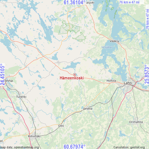
Hämeenkoski GPS coordinates[2]
61° 1' 19.992" North, 25° 9' 15.012" East
| Map corner | latitude | longitude |
|---|---|---|
| Upper-left | 61.36104°, | 24.45105° |
| Center: | 61.02222°, | 25.15417° |
| Lower-right: | 60.67974°, | 25.8573° |
| Map W x H: | 75.8×75.8 km | = 47.1×47.1mi |
| max Lat: | 69.90864° ⇑68.8% North |
| Hämeenkoski: | 61.02222° |
| min Lat: | ⇓31.2% South 59.83333° |
| min Long | Hämeenkoski | max Long |
| 21.2° | 25.15417° | 30.93276° |
| W 58.1%⇐ | ⇒41.9% E |
Elevation
Elevation of Hämeenkoski is 124 m = 407 ft, and this is 46.9 m = 154 ft above average elevation for this country.
| Max E: |
299 m = 981 ft | 15.8% |
| Hämeenkoski | 124 m 407 ft | |
| Avg. | 77.1 m = 253 ft | |
Min E: |
1 m = 3 ft | 84.2% |
See also: Finland elevation on elevation.city.
Geographical zone
Hämeenkoski is located in North temperate zone (between Tropic of Cancer and the Arctic Circle). Distance of this North polar circle is 616.1 km =382.8 mi to North.| Distance of | km | miles | from Hämeenkoski |
|---|---|---|---|
| North Pole | 3222 | 2002.1 | to North |
| Arctic Circle | 616.1 | 382.8 | to North |
| Tropic Cancer | 4179.1 | 2596.8 | to South |
| Equator | 6785 | 4216 | to South |


Nearby cities:
15 places around Hämeenkoski: (largest is in red/bold)
• Asikkala
28.5 km =17.7 mi,  40°
40°
• Auttoinen
31 km =19.3 mi,  353°
353°
• Hauho
35.9 km =22.3 mi,  297°
297°
• Hausjärvi
29.1 km =18.1 mi,  204°
204°
• Hollola
15.3 km =9.5 mi,  78°
78°
• Hollola
18.8 km =11.7 mi,  97°
97°
• Janakkala
32.9 km =20.4 mi,  245°
245°
• Järvelä
18.6 km =11.6 mi,  158°
158°
• Kärkölä
12.8 km =8 mi, 156°
• Lahti
27.7 km =17.2 mi, 99°
• Lammi
10 km =6.2 mi,  312°
312°
• Oitti
27.4 km =17 mi,  193°
193°
• Tervakoski
36.7 km =22.8 mi,  230°
230°
• Turenki
30.5 km =19 mi, 247°
• Tuulos
23.8 km =14.8 mi, 306°
Sources, notices
• [Note1] Compared only with cities in Finland existing in our database
• [Src1] Map data: © OpenStreetMap contributors (CC-BY-SA)
• [Src2] Other city data from geonames.org with taken over terms of usage.
• [Src3] Geographical zone / Annual Mean Temperature by Robert A. Rohde @ Wikipedia
