Lammi geodata
Lammi (Kanta-Hame) is a seat of a third-order administrative division; located in Finland in Europe/Helsinki (GMT+3) time zone. With population of 5,634 people, there are 186 cities with bigger population in this country. Compared to other cities in Finland, 67.1% of cities are located further ↑North; 55.3% of cities are located further ←West and 85.7% of cities have lower elevation than Lammi. Note1


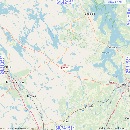
Lammi GPS coordinates[2]
61° 4' 59.988" North, 25° 1' 0.012" East
| Map corner | latitude | longitude |
|---|---|---|
| Upper-left | 61.4215°, | 24.31355° |
| Center: | 61.08333°, | 25.01667° |
| Lower-right: | 60.74151°, | 25.7198° |
| Map W x H: | 75.6×75.6 km | = 47×47mi |
| max Lat: | 69.90864° ⇑67.1% North |
| Lammi: | 61.08333° |
| min Lat: | ⇓32.9% South 59.83333° |
| min Long | Lammi | max Long |
| 21.2° | 25.01667° | 30.93276° |
| W 55.3%⇐ | ⇒44.7% E |
Elevation
Elevation of Lammi is 129 m = 423 ft, and this is 51.9 m = 170 ft above average elevation for this country.
| Max E: |
299 m = 981 ft | 14.3% |
| Lammi | 129 m 423 ft | |
| Avg. | 77.1 m = 253 ft | |
Min E: |
1 m = 3 ft | 85.7% |
See also: Finland elevation on elevation.city.
Geographical zone
Lammi is located in North temperate zone (between Tropic of Cancer and the Arctic Circle). Distance of this North polar circle is 609.3 km =378.6 mi to North.| Distance of | km | miles | from Lammi |
|---|---|---|---|
| North Pole | 3215.2 | 1997.8 | to North |
| Arctic Circle | 609.3 | 378.6 | to North |
| Tropic Cancer | 4185.9 | 2601 | to South |
| Equator | 6791.8 | 4220.2 | to South |


Nearby cities:
15 places around Lammi: (largest is in red/bold)
• Asikkala
29.9 km =18.6 mi,  60°
60°
• Auttoinen
24.3 km =15.1 mi,  9°
9°
• Hauho
26.3 km =16.3 mi,  292°
292°
• Hausjärvi
33.7 km =20.9 mi,  187°
187°
• Hollola
22.7 km =14.1 mi,  99°
99°
• Hollola
27.6 km =17.1 mi,  109°
109°
• Hämeenkoski
10 km =6.2 mi,  132°
132°
• Hämeenlinna
31.3 km =19.4 mi,  251°
251°
• Janakkala
30.3 km =18.8 mi,  227°
227°
• Järvelä
28.1 km =17.5 mi,  149°
149°
• Kärkölä
22.4 km =13.9 mi, 145°
• Oitti
33.4 km =20.8 mi,  178°
178°
• Padasjoki
32.9 km =20.4 mi,  25°
25°
• Turenki
27.8 km =17.3 mi, 228°
• Tuulos
13.8 km =8.6 mi,  302°
302°
Sources, notices
• [Note1] Compared only with cities in Finland existing in our database
• [Src1] Map data: © OpenStreetMap contributors (CC-BY-SA)
• [Src2] Other city data from geonames.org with taken over terms of usage.
• [Src3] Geographical zone / Annual Mean Temperature by Robert A. Rohde @ Wikipedia
